
Box Hill
Living In Essex, there’s not many places nearby with some decent hills where I can do some proper training. But if I head South onto the M25 I can reach the Surrey hills in around an hour or so, where you are literally spoilt for choice! Today I’m going to talk about one of my favourite places to hike in Surrey, the magnificent Box Hill.
Box Hill has so much to offer. With its outstanding scenery, wildlife and many viewpoints. No wonder it’s a firm favourite for hikers, cyclists, and for family days out. There’s so much to explore…there’s literally something for everyone!
Before we go any further, here are some fun facts about Box Hill…
Approx. 850,000 visit Box Hill every year
Over 38 species of butterfly have been spotted in Box hill in recent years
17 species of orchid have been recorded
Box Hill is one of the summits on the notorious Surrey 3 Peaks route - the other two being Leith Hill, and Holmbury Hill
Location: The Old Fort, Box Hill Road, Tadworth, Surrey, KT20 7LB
Getting there…
By Road: There’s a few car parks as you approach Box Hill. But the main car park is located at the top of Box Hill, opposite the Visitor Centre, KT20 7LB, or by using What3Words - Index.Logs.Twist
By Train: there are 2 stations relatively close by (if you’re willing and able to walk up the hill) - either Box Hill, or Westhumble
By Bus: The Metrobus 21 Epsom, takes you to Box Hill East car park (not on Sundays or Bank Holidays)
Facilities: Book shop, Cafe, Car Park, Toilets, Kiosk
Terrain: most of the routes in and around Box Hill include some steep pathways, steps, and uneven surfaces!
Routes: One of the things I love about Box Hill is that there are several circular routes to choose from. They either start from the information board outside the cafe, or by the Shepherd’s Hut in the Main Car Park. All are clearly signposted with coloured arrow markers. So even a novice walker shouldn’t get lost! Most of the routes cross over each other at some points, so you can mix your hike up if you choose.
Here are just a few of the most popular routes along Box Hill which I regularly visit…
Main Box Hill Hike
8 mile (12.8km) circular, with some steep climbs and descents, plus some challenging steps! This walk is fairly challenging, with approx. 300 metres (1,000 feet) of ascent, and takes around 2.5hrs-3hrs for an experienced speedy hiker, to 4hrs for many.
Highlights: Box hill visitor centre, Broadwood’s Tower, Mickleham church, Mickelahm Gallops, Cherkley Wood, Headley Heath, Box Hill viewpoint, Salomons Memorial, and loads and loads of steep steps!
Marc’s OS Maps route: https://explore.osmaps.com/route/2742779/box-hill-red-route-09-dec-2018-0913

The ‘Devil’s Staircase’ on the Main Box Hill Hike
I hike this route regularly, either solo or with friends. It always serves up a thrill, with its many steep staircases and variety of walking paths and tracks. A few of us even did this hike through the night! Spooky! Especially as the route takes you through a church graveyard!
If you fancy a challenge, then The Main Box Hill Hike is the one for you! So let’s take a closer look at this impressive hike!
Route
Like most of the routes in Box Hill, the Main Box Hill hike starts at the car park next to the visitor centre. This route is clearly marked throughout with red arrow signs. You head straight into the woods behind the Shepherd’s hut, and past the nature play trail, until you reach Broadwood’s Tower. Bear right and follow the path until you reach your first staircase! When you reach the bottom, turn left until you reach Whitehall car park.
After carefully crossing the road, you’re met with the imposing view of the steep staircase leading up in between the woods. I must admit, the first few times I climbed these stairs, It left me completely breathless, and unable to speak! But once you reach the top, there is a lovely bench where you can sit and rest if you wish, and take in some of the views! Moving on, you take a left fork in the woods, and make your way very carefully down a steep path.
At the bottom of the slope you climb over a stile, and take a right turn through the churchyard. You walk in between some fencing and follow the signs, and eventually come to the King William IV pub (option to stop for a drink of course), and take the staircase (oh you better get used to staircases on this walk!) up. After a very brief flat, you continue up slope, which is quite narrow and uneven, in between the trees. You stop with your mouth open and wonder how on earth not one but two cars (completely smashed) managed to get here at the side of the path in a ditch! It’s a debate that my friends and I have had every time we’ve walked here.
Eventually you reach the top of the slope and enter into a wide open space, The Gallops, on top of Whitehill. I love this part of the walk, as it’s open and airy (very much needed after your efforts so far), and is fairly flat. But like all things on this route, flat doesn’t last long! At the end of the Gallops, you turn right and the path heads down a very steep slope. At the bottom you cross over the road and again climb up hill until you reach Gate 26. Go through the gate and onto Headley Heath, turning left at the cross path.
At the bottom of the slope, take the short stairs (nice for a change) on your right and then bear left up hill. the views at the top of the hill are amazing! Keep going, following the signs and then head left, and then follow straight until you reach Gate 23, onto a private road where you turn left. At the top of the road you cross over and head back into the woods again. Eventually you come to yet another set of stairs on your right. Obviously you have to take them! At the top, turn left, and you now have a flat stretch of path (phew!). There’s a bench on your left where you get some impressive views!
Cross over another stile and the path heads gently downhill. On reaching the road, turn left then right immediately and follow the red arrow signs towards Box Hill. After going through a gate you now have the infamous Box Hill itself to climb (on your right). Take it slowly uphill, until you reach Salomon’s Memorial. Congratulations! What an epic hike! Now for some photos and a pat on the back! Then take a left back to the car park and visitor centre.
Stepping Stones Walk
The Stepping Stones are an iconic landmark, and are a very popular place to visit. Set down in the valley on the River Mole, the Stepping Stones lie in wait, tempting you to take this route across the water. The walk itself is a moderate one, only a few kms in length, usually taking an hour or so. The challenge are the infamous 275 steps, whether you’re ascending or descending, they are steep in some places. So decent footwear is essential.
Highlights: Salomon’s Memorial, Box Hill view point, 275 steps (up or down), River Mole, Stepping Stones, Burford Meadow, the Whites (chalk cliffs), Box Hill Fort
Marc’s OS Maps route: https://explore.osmaps.com/route/17986631/box-hill-stepping-stones
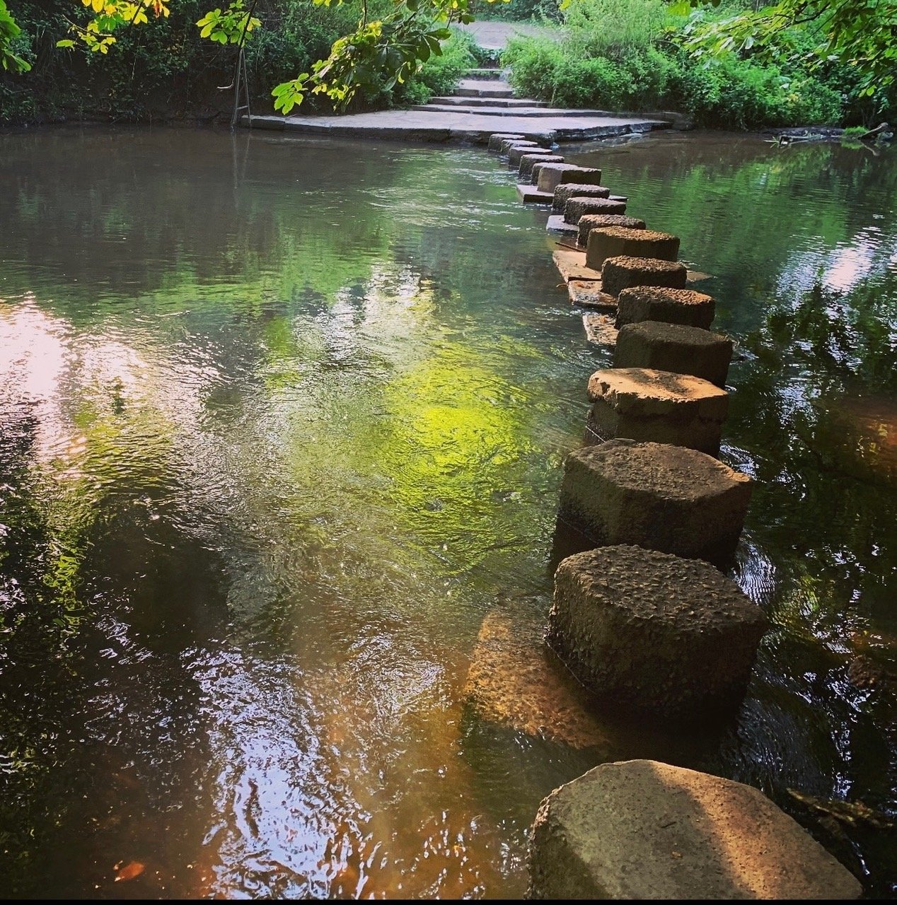
The infamous Stepping Stones!
Route
You’ve got two options here, depending on whether you want to walk up or down the 275 steps! I regularly walk this route in reverse, so I can ascend the steps towards the finish. however, today I’ll describe this route taking the slightly easier option of going down the steps! Either way, it’s a relatively short walk (approx. 2 miles), usually taking under an hour.
Starting from the Main Box hill car park, head towards Salomons Memorial, and take the path to the right which overlooks Box Hill until you come to a gate. On going through the gate, take a left, and towards the infamous 275 steps. Don’t worry, the steps aren’t continuous, as they broken down into shortish sections (giving your knees some welcome respite).
when you reach the bottom of the stairs, you reach the River Mole, with its stepping stones, which lie in wait if you wish to cross over them. You can obviously choose to do this (although this option isn’t always available if the water is running high). Or you can follow the river to the right until you get to a footbridge, and then cross over there.
You then go straight across Burford Meadow, with the chalk cliffs behind you, until you reach the road. Turn right and past the hotel, which takes you past Ryka’s cafe.
Turn right here, and the path goes steeply uphill. Eventually you turn right and head along a ridge for a while, until you come to Box hill Fort. Keep going, and you’ll soon be back at the Visitor Centre, where you can grab a well-earned coffee (oh and one of their famous slices of cake - rude not to!).
Happy Valley Circular Walk
This route is ideal, if you fancy taking in some of Box Hill’s most beautiful scenery, including Broadwood’s Tower. This walk treats you to some glorious views of the Surrey countryside. The walk itself is a moderate one, approx. 2.7 miles (4.3kms), taking around 90 minutes for most people.
Highlights: Broadwood’s Tower, Salomon’s Memorial viewpoint, outstanding views
Marc’s OS Maps route: https://explore.osmaps.com/route/16780840/box-hill-happy-valley-circular-walk

Broadwoods Tower
Route
Starting from the Main Box Hill car park, you begin by following the main Box Hill red arrow markers until you reach Broadwood’s Tower. From here it offers an impressive view down into the Valley (hence the name), and the large imposing house below, Juniper Hall.
Then head off down a series of steep steps until you reach the valley. At the bottom you make a right. Follow the path until you reach a road (this is where the Smith and Western restaurant is located). Cross the road and turn right. Follow the path along the North Downs Way all the way back to Salomon’s Memorial and the view point. Then head back to the car park and visitor centre.
Juniper Top Circular Walk
This is one of my favourite walks (to be honest, they’re all great). But I like this walk in particular because a) the views of the North Downs, and b) the variety of scenery, which changes with the seasons - check it out in Spring when the bluebells are out in full force! The route is approx. 4 miles (6.4kms), which usually takes around 90 minutes to 2 hours. Although some steep steps in sections, it’s only a mildly challenging walk, and well worth a go!
Highlights: Salomons viewpoint, woodland, Box Hill bluebells, Juniper top views - including 3 grand houses, trees and flowers
Marc’s OS Maps route: https://explore.osmaps.com/route/5038361/junpier-top
View from Juniper Top
Route
Starting (as like many others) from the Visitor Centre car park, you head towards Salomon’s Memorial viewpoint. passing the viewpoint you head into the woods, and follow the purple coloured arrow markers. You eventually emerge by the Smith and Western restaurant. Cross over the road and join the path through the woods once more.
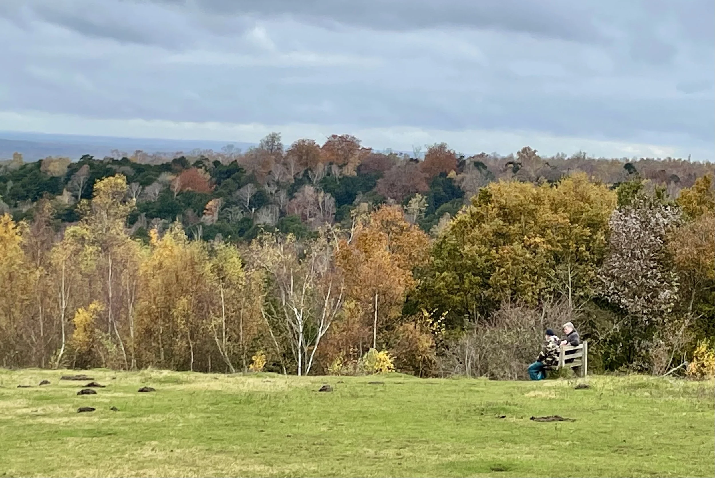
Keep following the purple makers, and after a while you’ll reach a left turn where you’ll enter the Bluebell woods (best time obviously is in Spring when they are out in full force!). Keep following this path until you reach Juniper Top. This is a wide open area which offers some outstanding views to the left. I love it here in Autumn, with all its golden colours!
Walking down the hill, which is quite steep in places, you come to a gate at the bottom, and turn left. From here you simply follow the Happy Valley/Juniper top signs. It’s a long gentle incline all the way back up and to the car park.
Summary
Box Hill has been my training ground for the past few years, due to the ascents and descents, steep steps, and just for it’s outstanding beauty! All of this makes it an ideal place to train for any ultra challenge!
Thanks for reading folks! Hope to bump into you at Box Hill sometime.
Happy hiking!
Marc
If you enjoy my blogs feel free to buy me a coffee!