
Seven Sisters to Alfriston Loop
Seven Sisters & the South Downs National Park
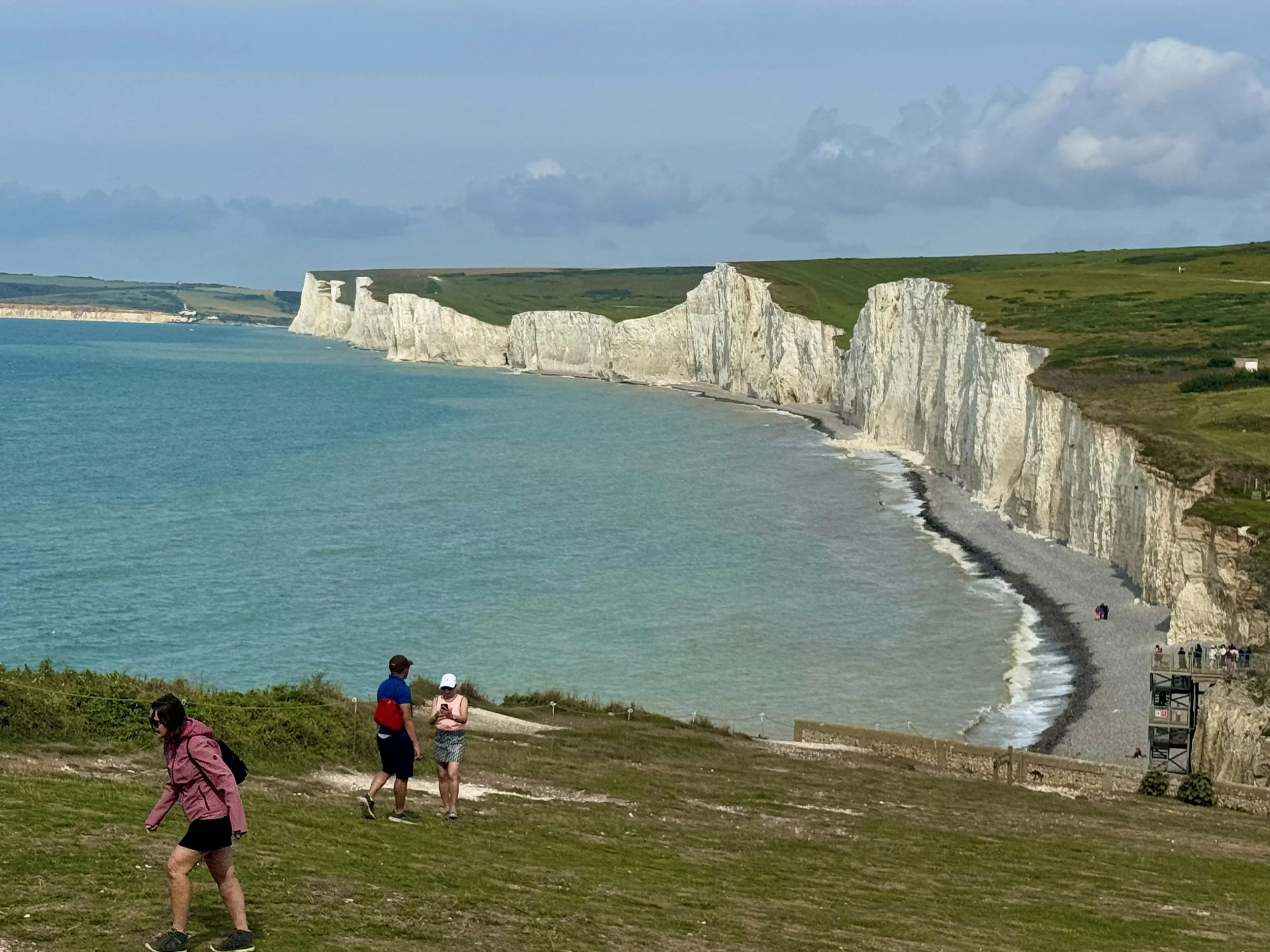
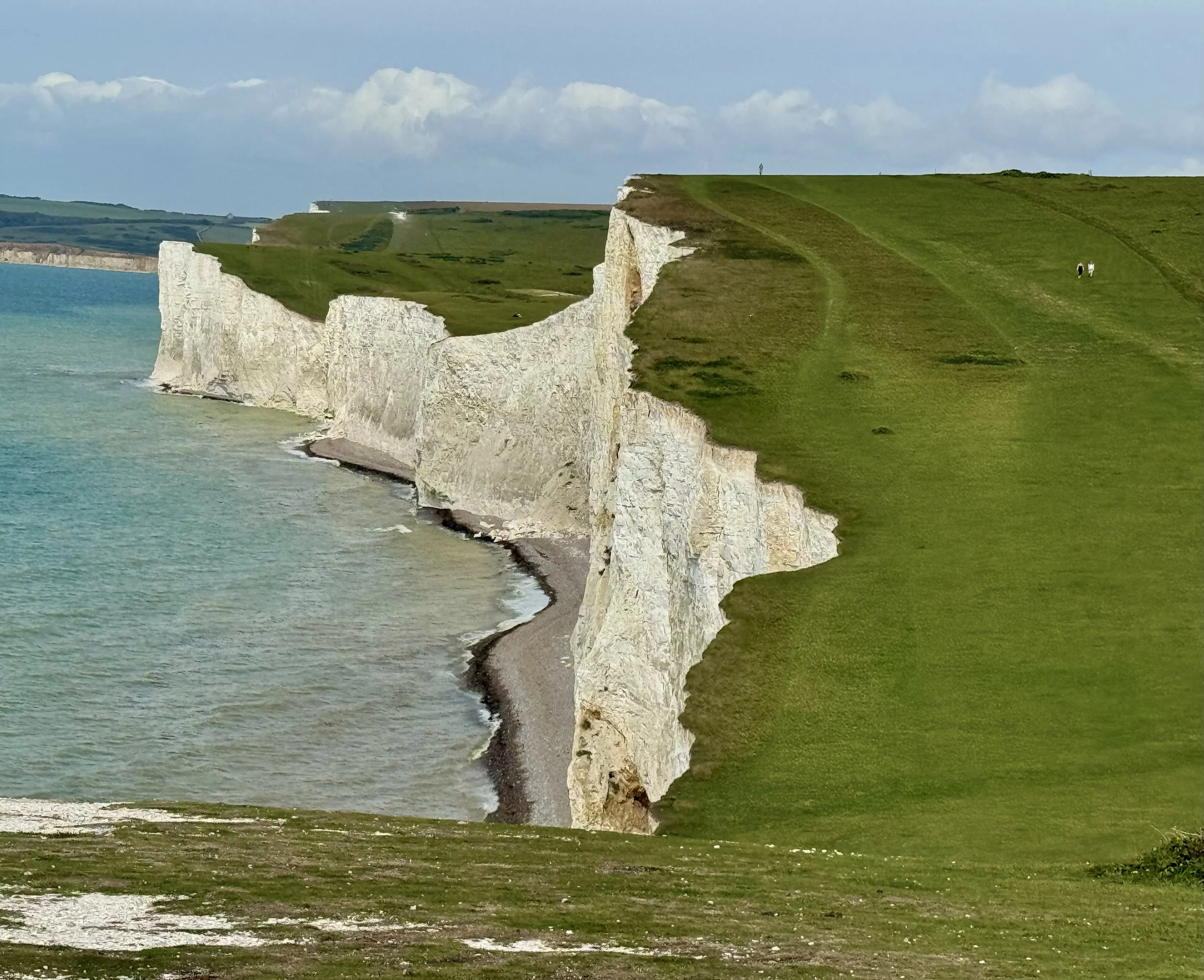
The Seven Sisters are one of Britain’s most iconic coastal landscapes — a breathtaking chain of chalk cliffs that gleam brilliant white against the turquoise waters of the English Channel. Located between Seaford and Eastbourne in East Sussex, these seven undulating cliff peaks are unspoiled and offer a raw, natural beauty.
Each “sister” is a distinct rise and fall in the cliffs, carved over millennia by the relentless action of sea and weather. Popular viewpoints like Birling Gap, Beachy Head, and Cuckmere Haven give walkers some of the most dramatic panoramas in the UK.
These cliffs form part of the wider South Downs National Park — England’s newest national park, designated in 2010. Spanning over 1,600 square kilometres from Winchester in Hampshire to Eastbourne in East Sussex, the park is a rolling tapestry of chalk hills, ancient woodlands, river valleys, and open downland. Its high ridges provide sweeping views over both the sea and the patchwork fields of the Weald, while its trails — including sections of the South Downs Way — offer some of the country’s best long-distance walking.
Beyond the dramatic coastline, the South Downs is rich in history and wildlife. Iron Age hill forts crown its heights, rare orchids bloom in its chalk grasslands, and skylarks fill the air with their song. It’s a place where you can combine wild coastal hikes with gentle village strolls, stopping at traditional pubs or tearooms in charming spots like Alfriston and Lewes.
The Seven Sisters and South Downs together offer a perfect blend of natural drama and pastoral calm — ideal for walkers, photographers, and anyone seeking a true taste of southern England’s great outdoors.
The Seven Sisters
The Seven Sisters Country Park is the unmistakable jewel in the crown of the South Downs National Park. However, it may surprise you to know that despite their name, there are actually 8 sisters…the eighth one being created by the erosion of the sea.
Most resources on the internet list them from West to East. But seeing as my walk took me from Eastbourne to Alfriston, here they are listed from East to West…
Went Hill Brow
Baily’s Hill
Flat Hill
Flagstaff Point
Brass Point
Rough Point
Short Brow
Haven Brow
The Seven Sisters cliffs are occasionally used in filmmaking and television production. For example, they are seen in the background of the Quidditch World Cup in the 2005 film Harry Potter and the Goblet of Fire.
Best Time to Go
Spring: Wildflowers along the cliffs & heath.
Summer: Long daylight hours for the full loop.
Autumn: Crisp visibility & warm light on the chalk.
Winter: Only for experienced hikers — very exposed on cliffs.
Getting There
By Car
Set sat nav to: Beachy Head Kiosk, Duke’s Drive, Eastbourne BN20 7XL
Parking is free along Dukes Drive, or alternatively parking is available nearby at Beachy Head car park (pay & display).
By Train
Direct services from London Victoria to Eastbourne take around 1h 30m.
By Bus
Stagecoach Coaster 12/12A/12X runs from Eastbourne to Beachy Head/Birling Gap/Seaford — ideal for linear or loop variations.
Or, if you want to add some more distance into your route, then you can walk from Eastbourne Station to Beachy Head Kiosk (~4 km / 45–60 min)
Exit Eastbourne Station → turn left on Grove Road.
Follow past the library and theatre → right onto Meads Road.
Continue to Beachy Head Road → turn left.
Uphill past car park → right into Duke’s Drive.
Kiosk on right-hand side.
Facilities
Cafés: Birling Gap, Alfriston, East Dean
Toilets: Birling Gap, Cuckmere Inn, Alfriston
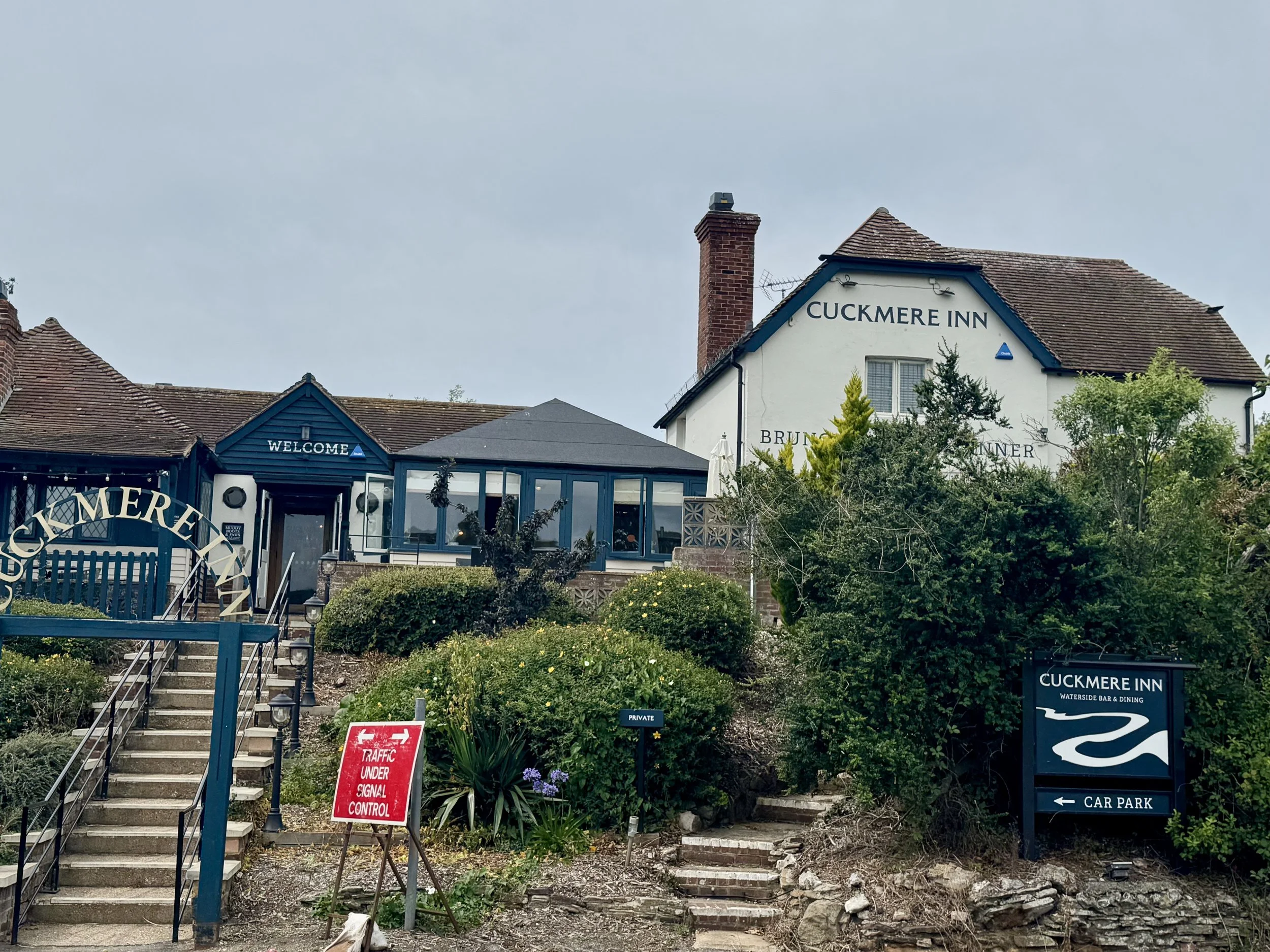
Pubs: Tiger Inn (East Dean), George Inn (Alfriston), Cuckmere Inn
Transport: Buses between Eastbourne, Birling Gap, Seaford; seasonal tourist bus
Tips
Keep well back from cliff edges — chalk crumbles without warning.
The Seven Sisters section is physically demanding: seven steep climbs & descents.
Carry enough water — refill points are limited inland.
A GPX track is highly recommended for the inland section via Hobb’s Eares & Friston.
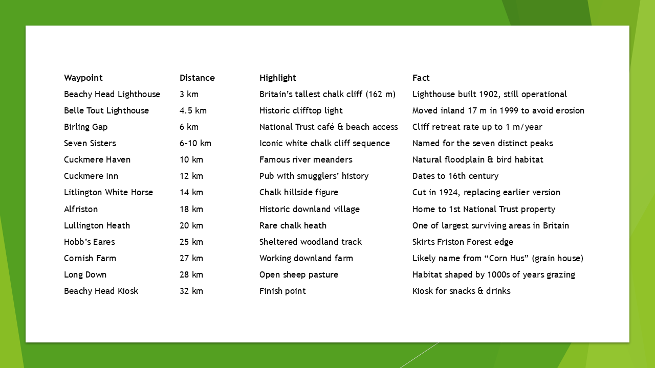
Route Overview
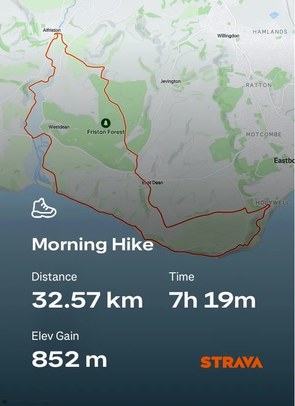
My 32 km / 20 mile circuit packs in the South Downs’ greatest hits: the dizzying cliffs of Beachy Head and the Seven Sisters, the serenity of the Cuckmere Valley, the historic heart of Alfriston, and the wildlife-rich heathland and woodland tracks on the return.
It’s one for fit, experienced hikers seeking variety, challenge, and big views in every season.
Alternatively, you can shorten the walk as you see fit. To make things easier for you, in my blog i’ll split this hike into 4 point-to-point sections (see my Step by Step Route further down) .
Distance: 32 km / 20 miles
Time: 7-8 hrs (full day)
Difficulty: 🟠 Moderate (long distance, steep climbs & descents)
Start/Finish: Beachy Head Kiosk, Duke’s Drive, Eastbourne
OS Map: OL25 – Eastbourne & Beachy Head
Waymarks: South Downs Way (coastal), public bridleways (inland return)
Marc’s GPX Download: Seven Sisters to Alfriston Loop
Route Highlights & Facts
Route Map
Choose to follow the route via my OS Maps link, or AllTrails
Step-by-Step Route
Section 1
Beachy Head Kiosk → Beachy Head Lighthouse (3 km)
Begin on the clifftop path west. Sweeping views over Eastbourne give way to the towering chalk drop and lighthouse below.
Beachy Head Lighthouse → Belle Tout Lighthouse (4.5 km)
Undulating grassland leads past this historic lighthouse, now a B&B, with panoramic sea views.
Belle Tout → Birling Gap (6 km)
Pass the cliff cottages before descending to the National Trust site — ideal for a coffee stop.
Birling Gap → Seven Sisters → Cuckmere Haven (10 km)
The rollercoaster cliff walk over the Seven Sisters ends at the Cuckmere estuary.
Section 2
Cuckmere Haven → Cuckmere Inn (12 km)
Follow the inland path to the visitor centre and pub.
Cuckmere Inn → Litlington White Horse → Alfriston (18 km)
Riverside walking through meadows to the historic village — perfect for lunch.
Section 3
Alfriston → Lullington Heath (20 km)
Climb to the open heath for views and rare wildflowers.
Lullington Heath → Hobb’s Eares (25 km)
Drop into the sheltered bridleway along Friston Forest’s edge.
Section 4
Hobb’s Eares → Cornish Farm → Long Down (28 km)
Pass through working farmland and rolling grassland.
Long Down → Beachy Head Road → Beachy Head Kiosk (32 km)
Cross the road, regain clifftop views, and return to the start.
BLOG
Seven Sisters to Alfriston Loop
Section 1: Beachy Head Kiosk to Cuckmere Haven (10km)
It’s mid-August in the height of the UK Summer, and i’ve come to the South Downs with my good friend Richard (Rich).
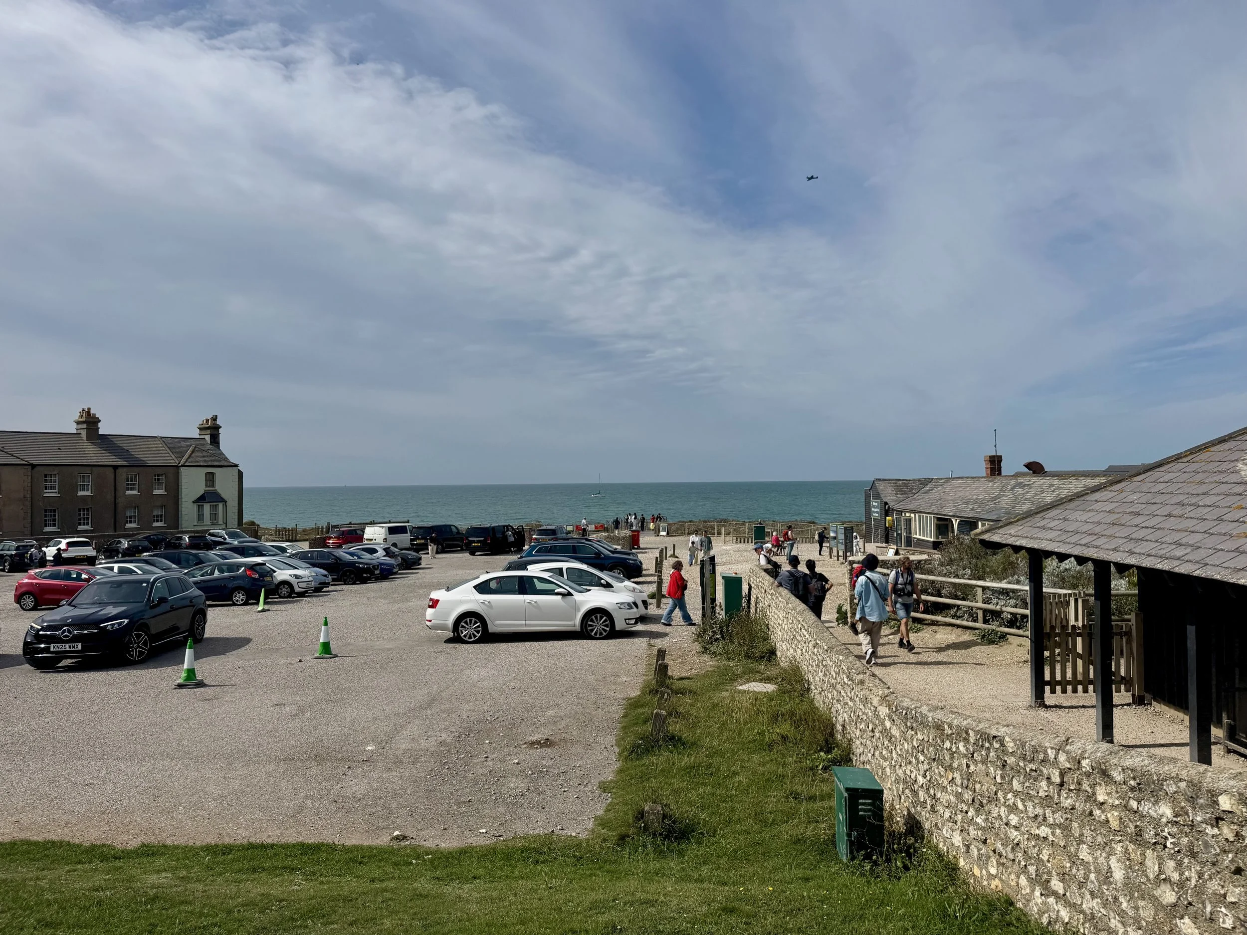
We parked, for free, in Duke’s Drive, close to the Beachy Head Kiosk, where are journey begins.
A large signpost indicates to take the left path towards Beachy Head. However, having walked here before, i decide to take the path direct up the hill, and sweep around to the left in a while.
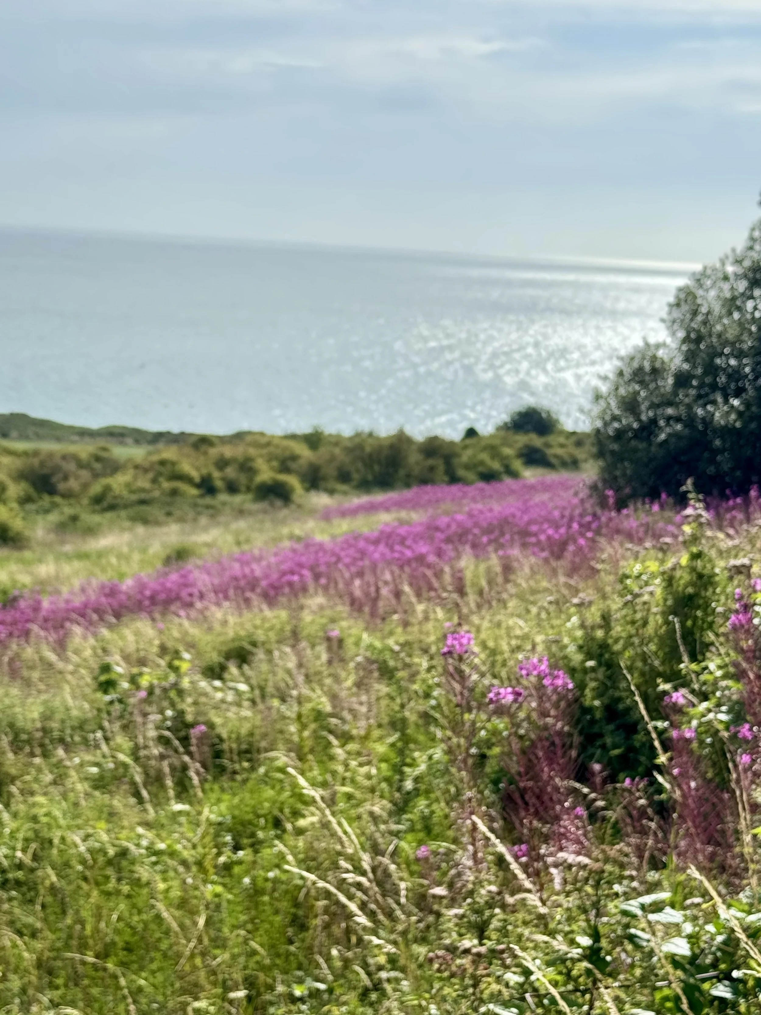
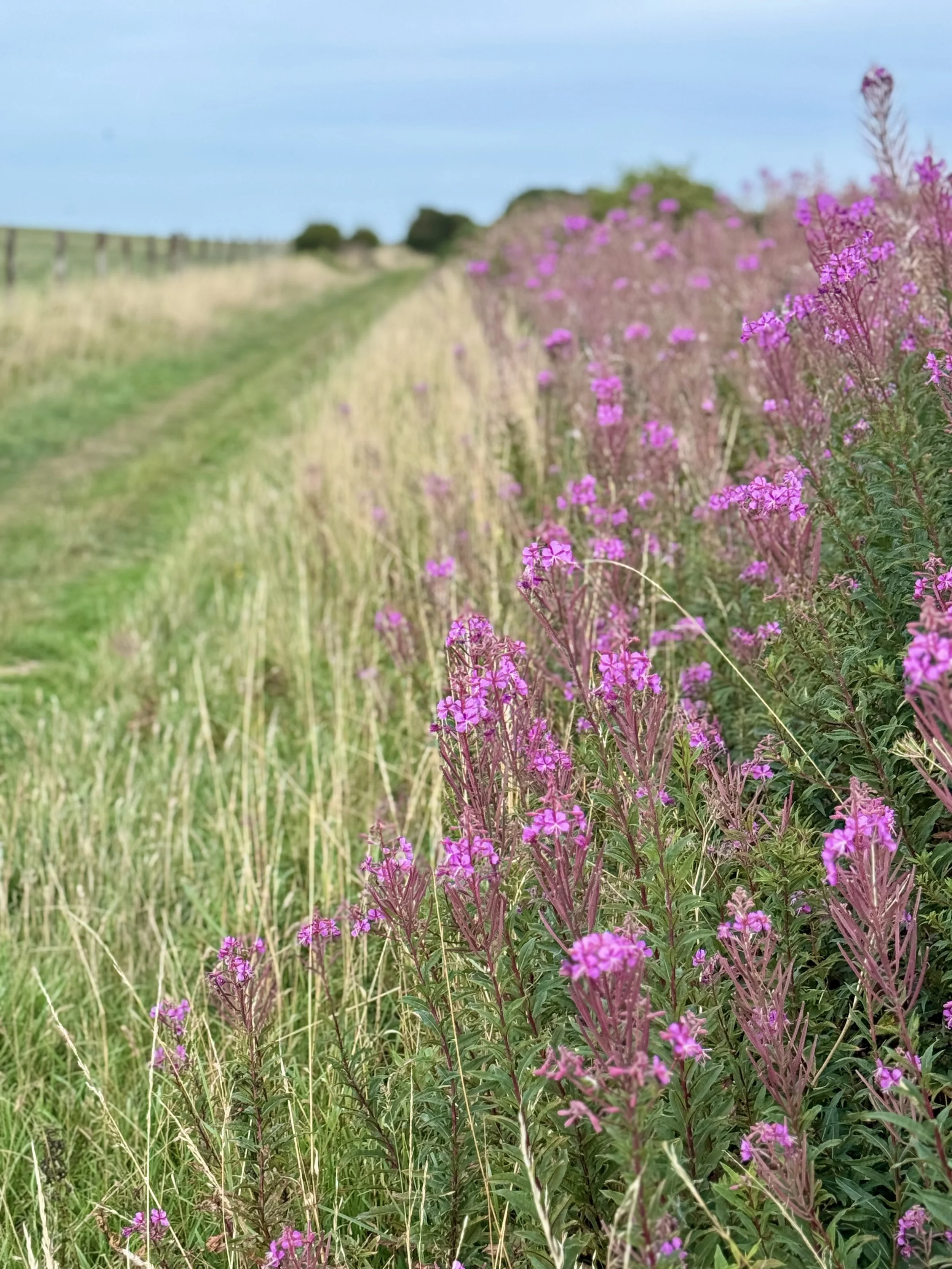
It’s not long before we reach the brow, where the view opens up. The sea glistens to our left, with bright pink Fireweed rising high along the fields. It’s a beautiful start to our day ahead.
It’s an easy going track, that weaves its way around the hills. There are a few options we could take that would lead us the general direction of Beachy Head, and we decide to take a slight fork to our right, up some steps, before it sweeps back to the left again.
30 minutes or so into our walk, and we arrive at the Beachy Head WW11 Memorial, and down below a little further, we spot the iconic red and white stripped lighthouse. (3km).
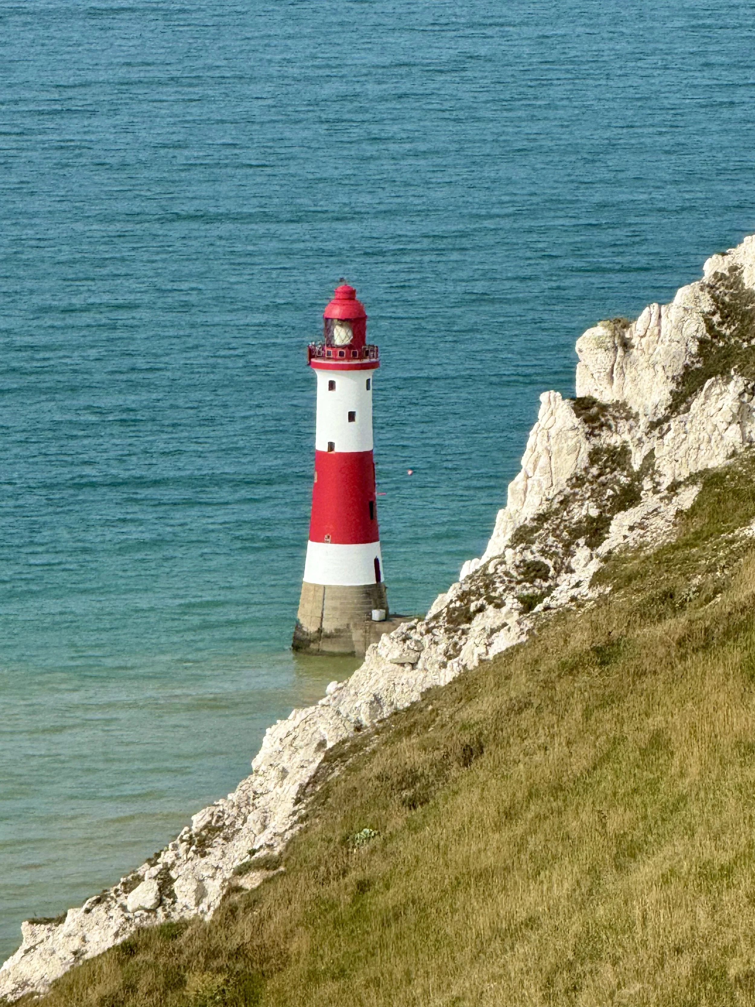
Perched high, we can see our path stretched out in the distance, as it opens up onto a wide expanse of rolling green fields. Rising above the next hill we see the Belle Tout Lighthouse, now a B&B, with panoramic sea views.
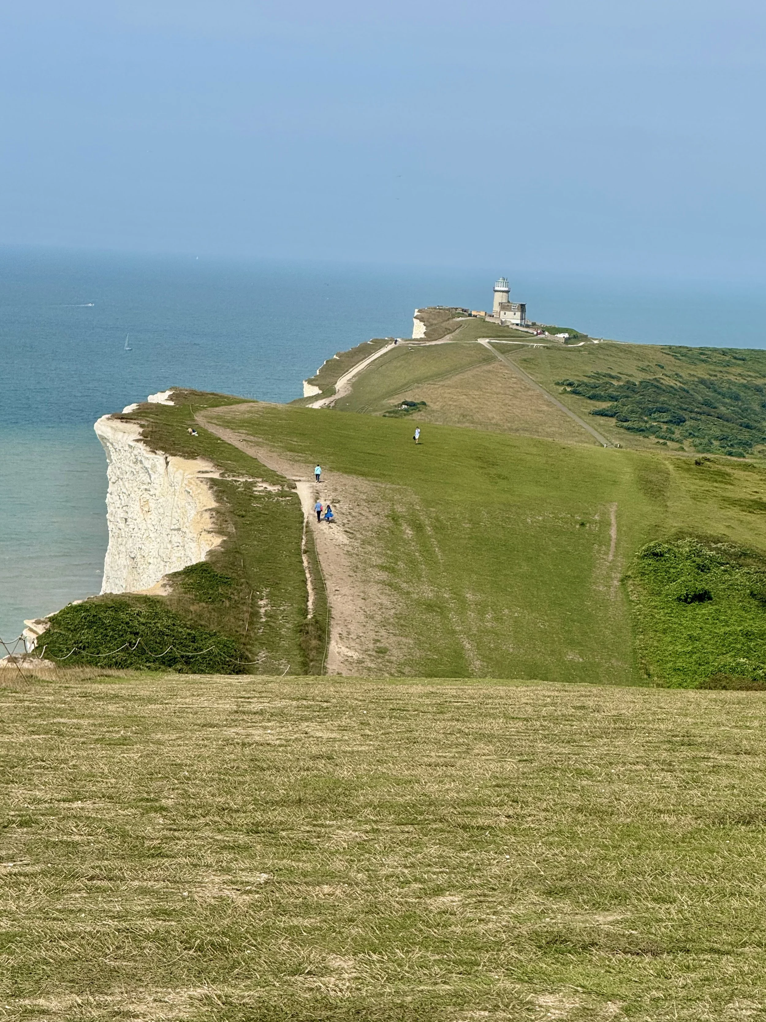
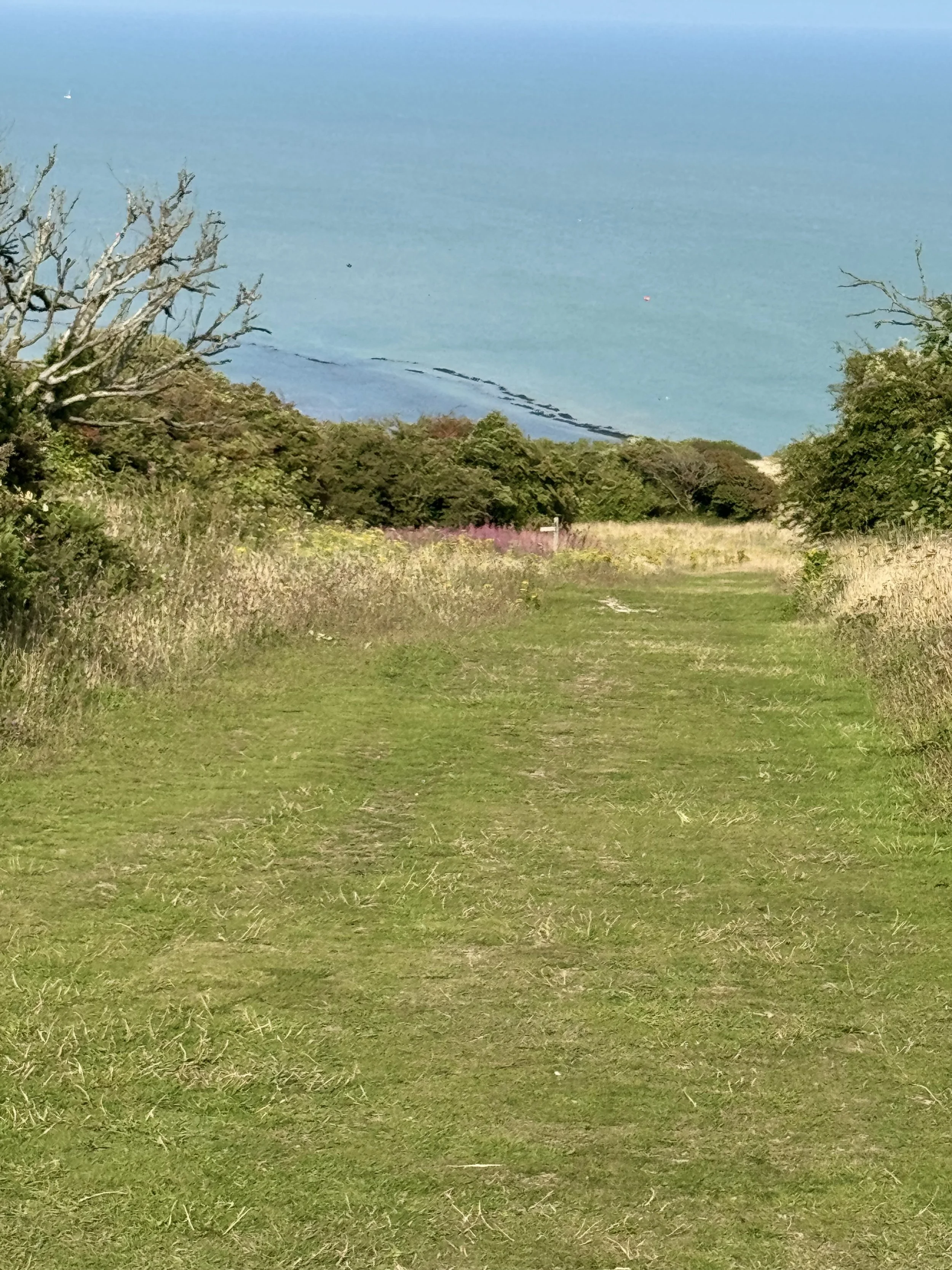
After passing the lighthouse (4.5km), the path descends, and we get our first glimpse of the Seven Sisters in the distance.
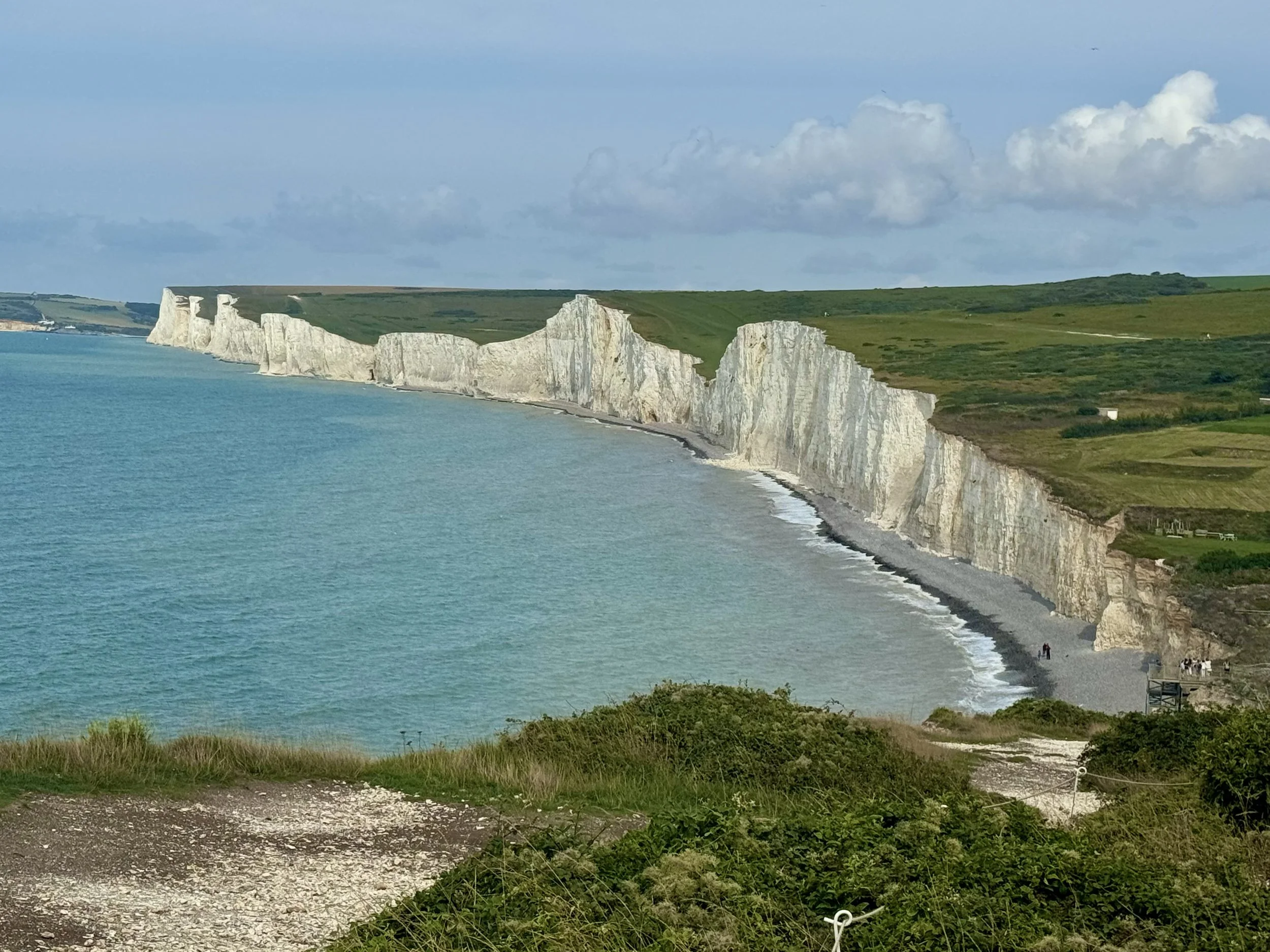
We descend further until we arrive at Birling Gap (6km). There is a National Trust (NT) cafe, toilet facilities, and access to the beach.
We head onto a stony path/road, and a little further we take a left fork back onto a path that leads us to the first ‘Sister’ - Went Hill.
From here we get a closer look at the rise and fall of the other ‘Sisters’ that lie ahead.
On such a warm Summer’s day it feels great to feel the breeze that’s being blown across from the sea.
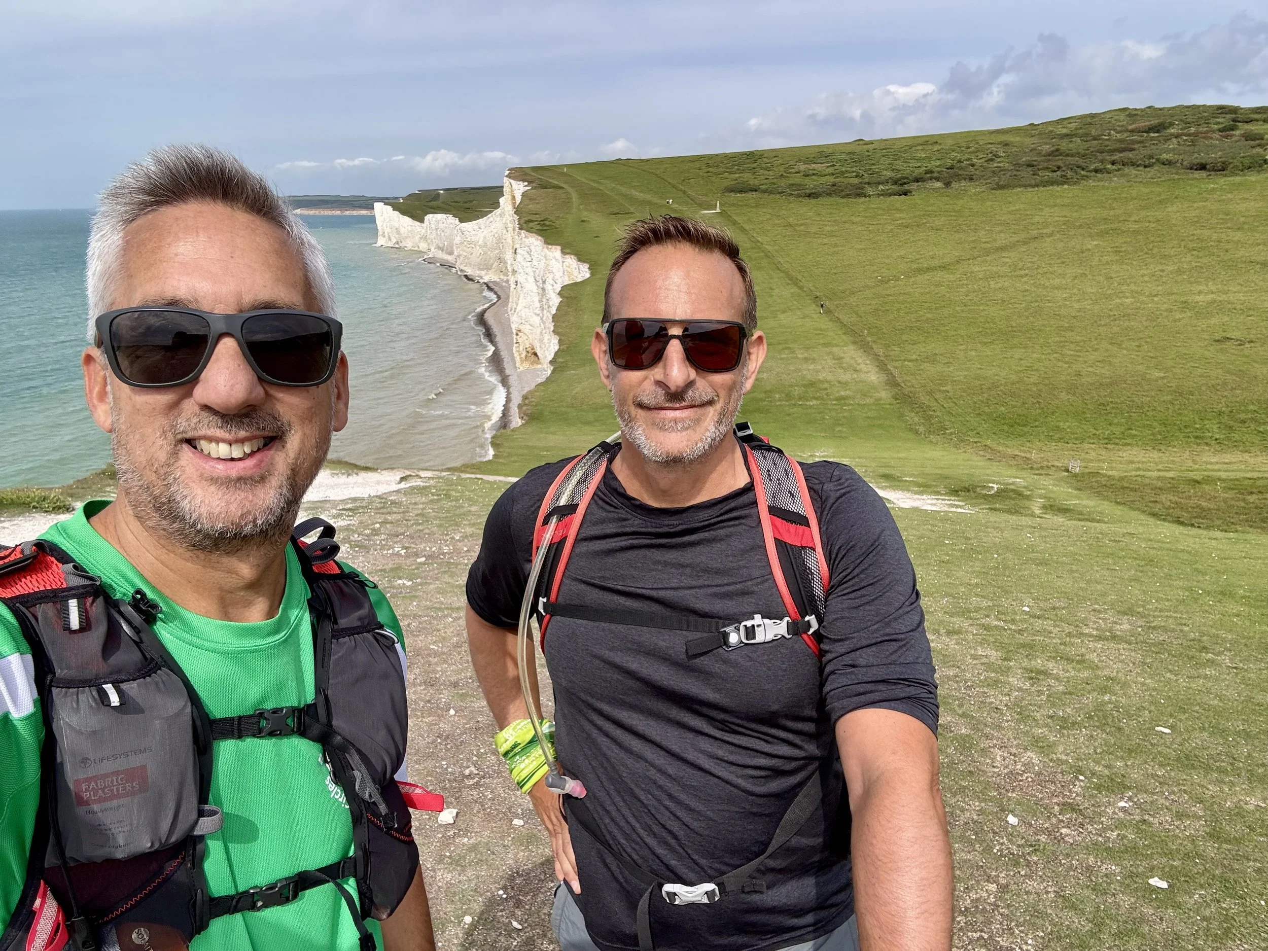
For the next 30-40 minutes, Rich and i navigate the Seven Sisters, slowly counting them off one by one. They are a treat…assuming you’re like me, and you get a kick out of hills!
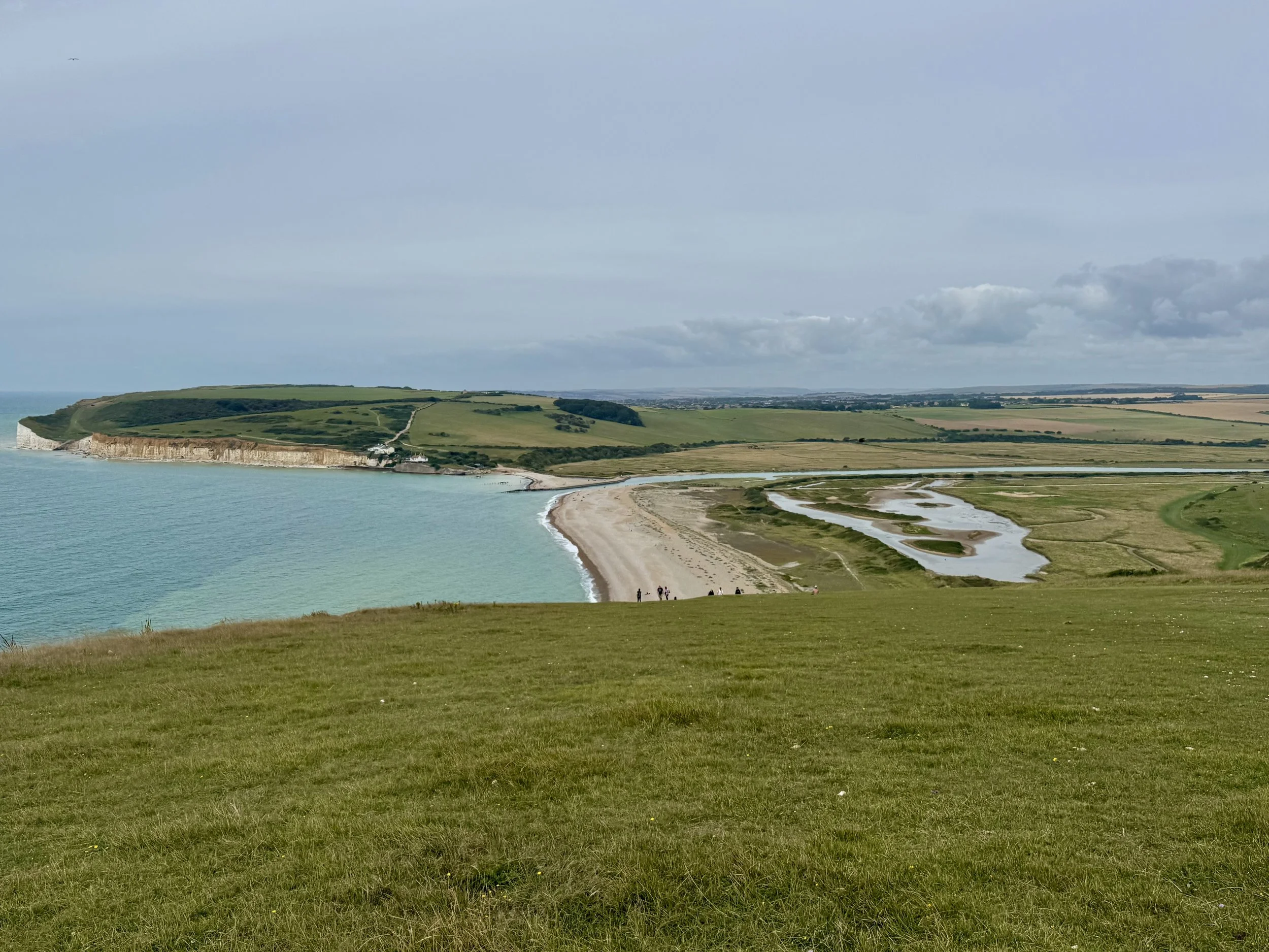
Eventually, after ascending the final Sister, Haven Brow, we reach Cuckmere Haven, where our path takes a turn inland to the right. (10km).
Section 1 completed.
Section 2: Cuckmere Haven to Alfriston 8km (18km/32km)
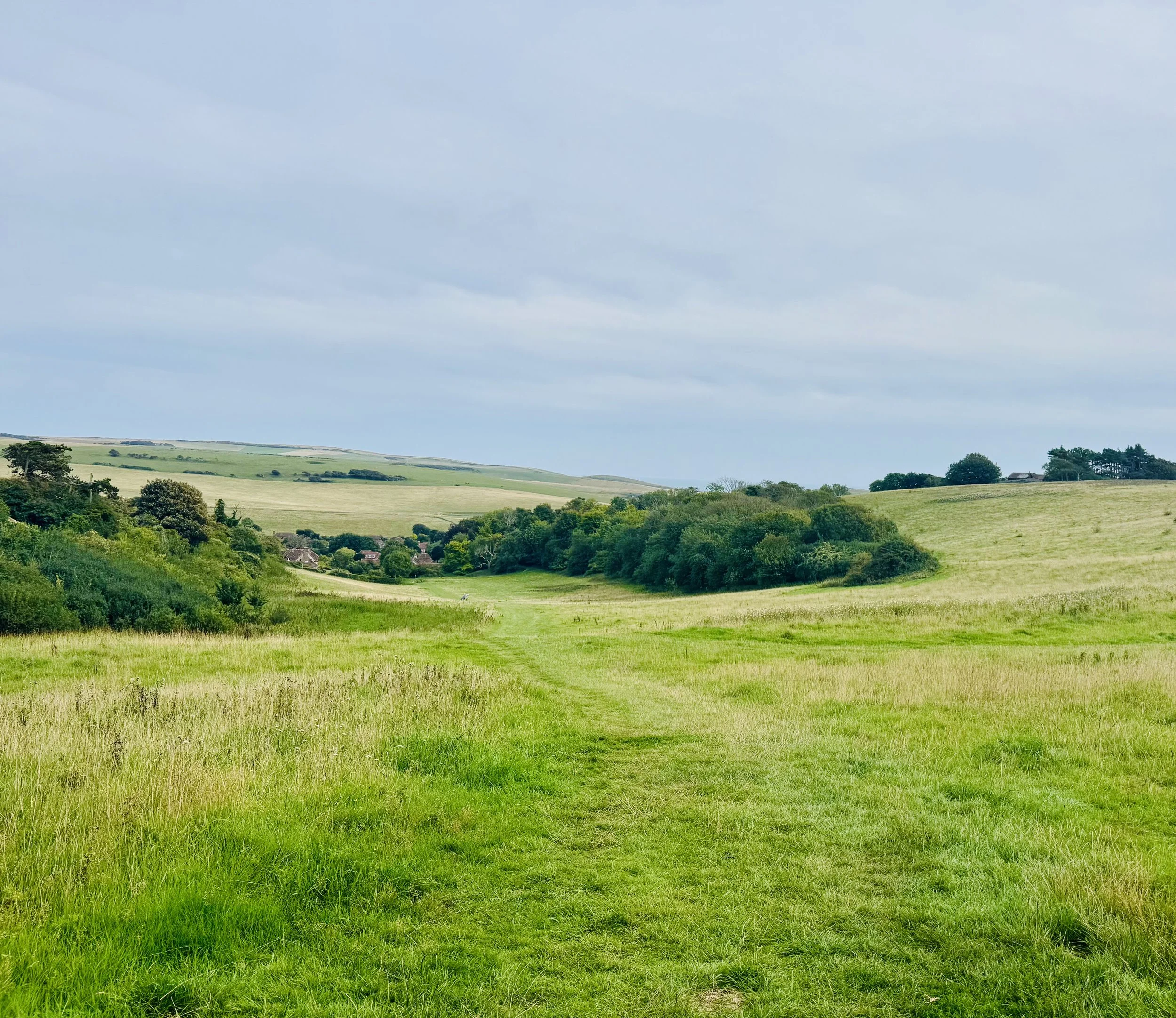
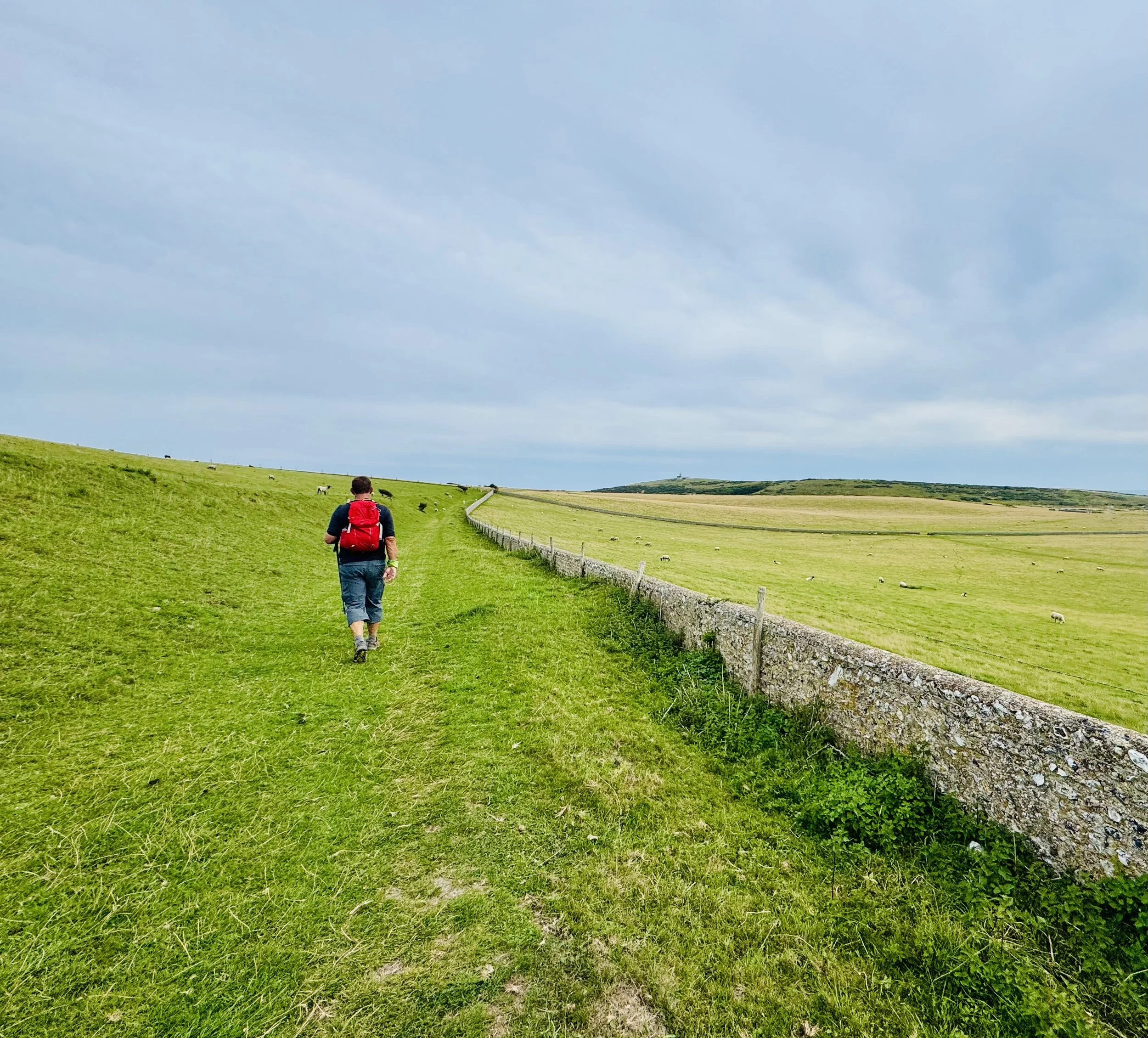
Once making our way across the Downs, the path heads downhill and onto a flat track, which runs alongside the Cuckmere River.
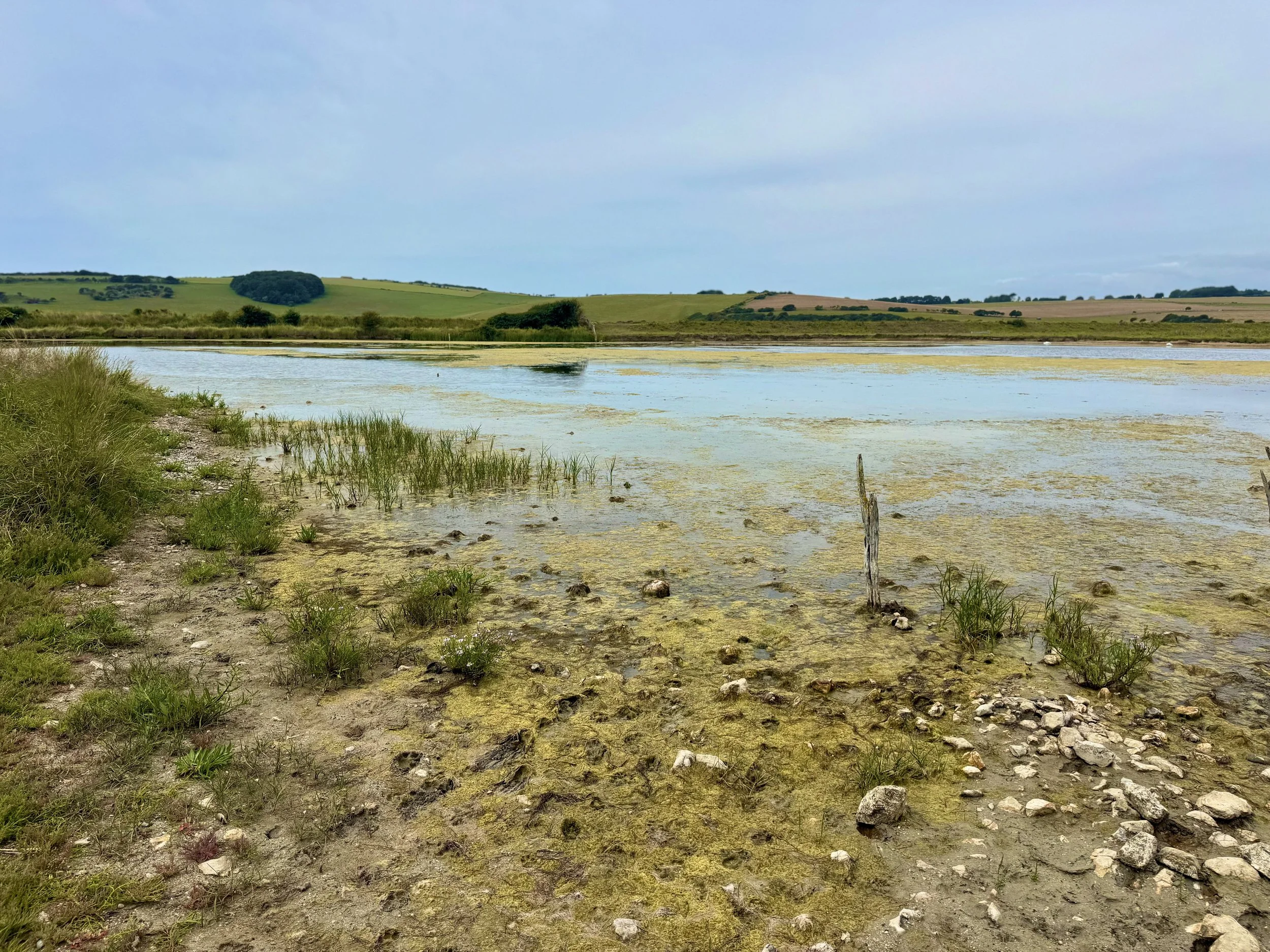
It’s an easy going path, offering a respite from the hills, as we continue along the track until crossing a small bridge (11km). We re-join the path, and then come to a road, the A259. To the left is the Cuckmere Haven Inn.
It’s a lovely pub restaurant. So you can either take a break here, or continue towards Alfriston.
Cross the road, and go through a gate, and back onto the England Coast Path (12km).
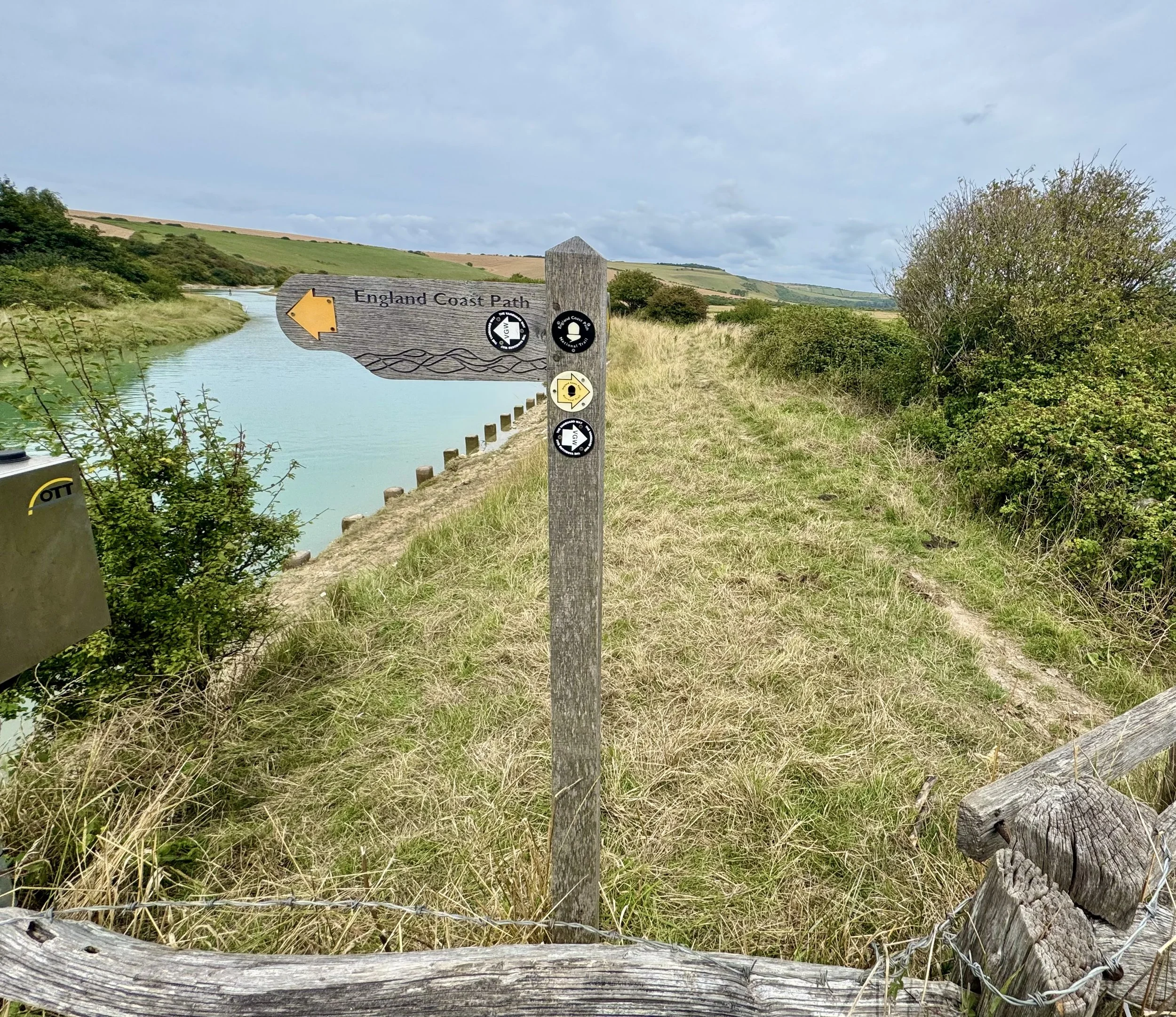
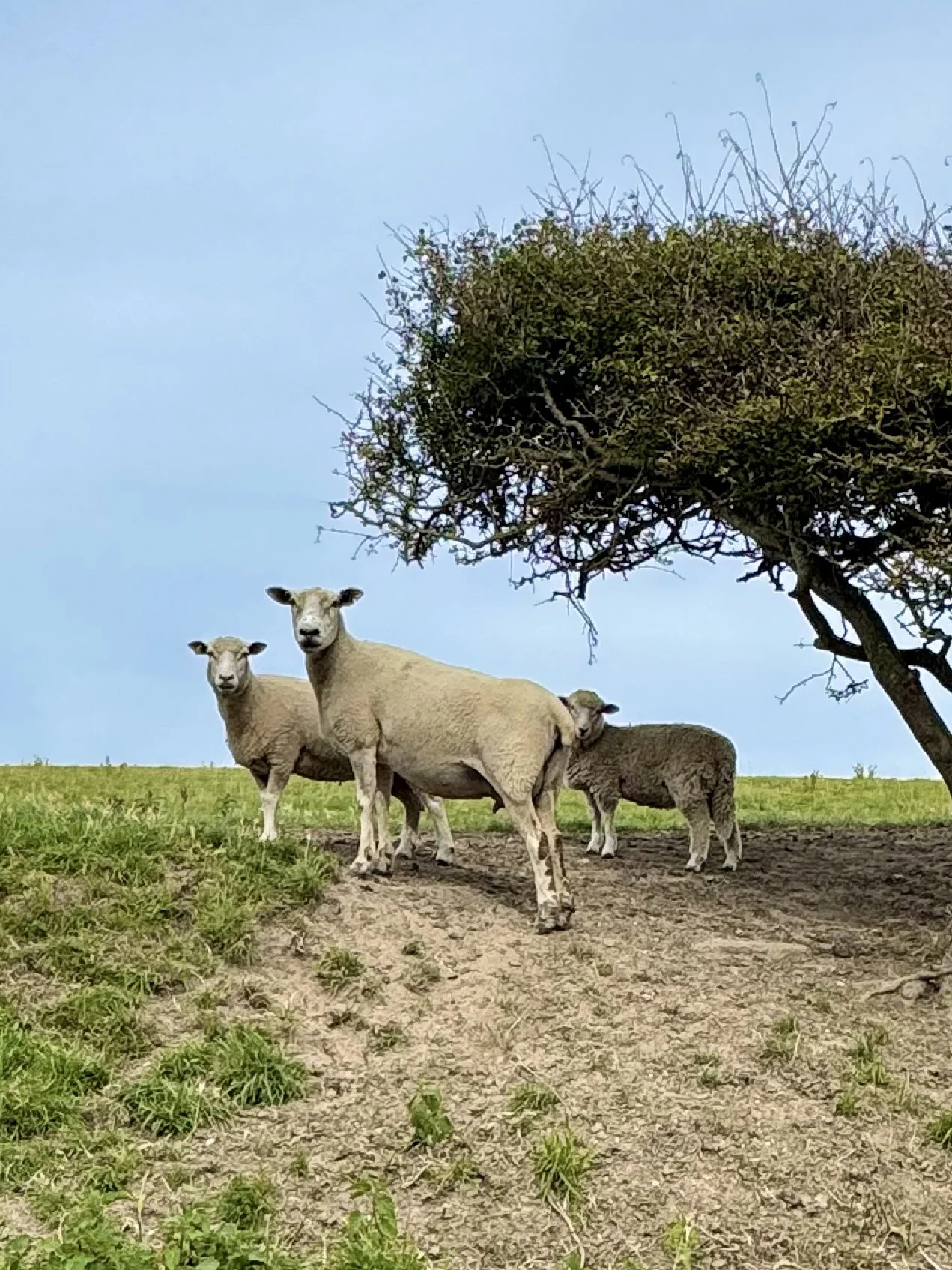
Although Rich and i have been going for 3 hours, and are looking forward to reaching Alfriston, we’re both enjoying the peace and solitude of this meandering track alongside the river. A natural habitat for an array of wildlife, with over 200 species of bird, it’s a real treat!
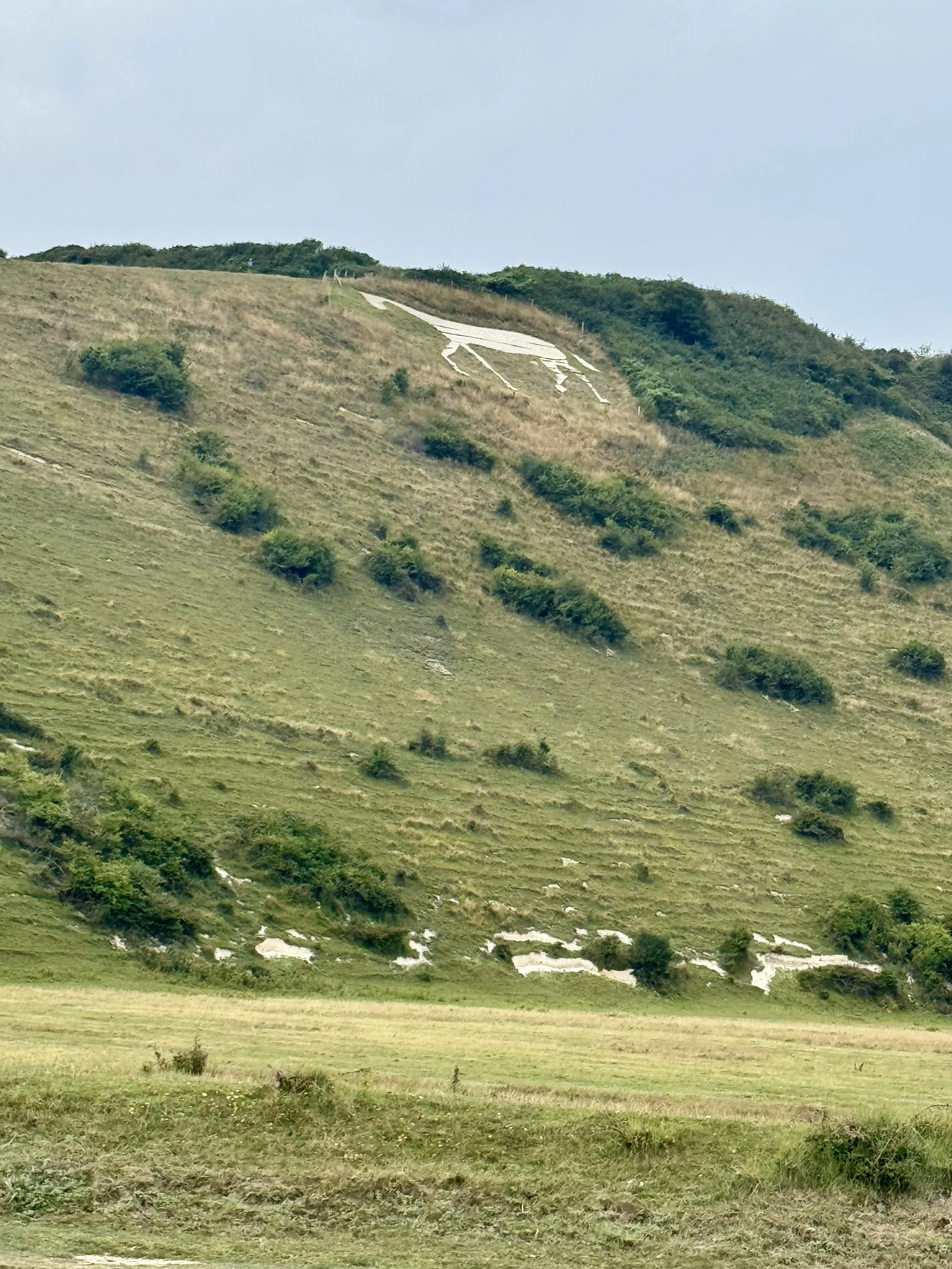
After 20-30 minutes, we come to the unmistakable chalk hillside figure of the Litlington White Horse (14km).
We continue to follow the path, admiring the tall grasses that brush the riverbank. The distinct sounds of the Common Shelduck can be heard as they take shelter in the thick grass.
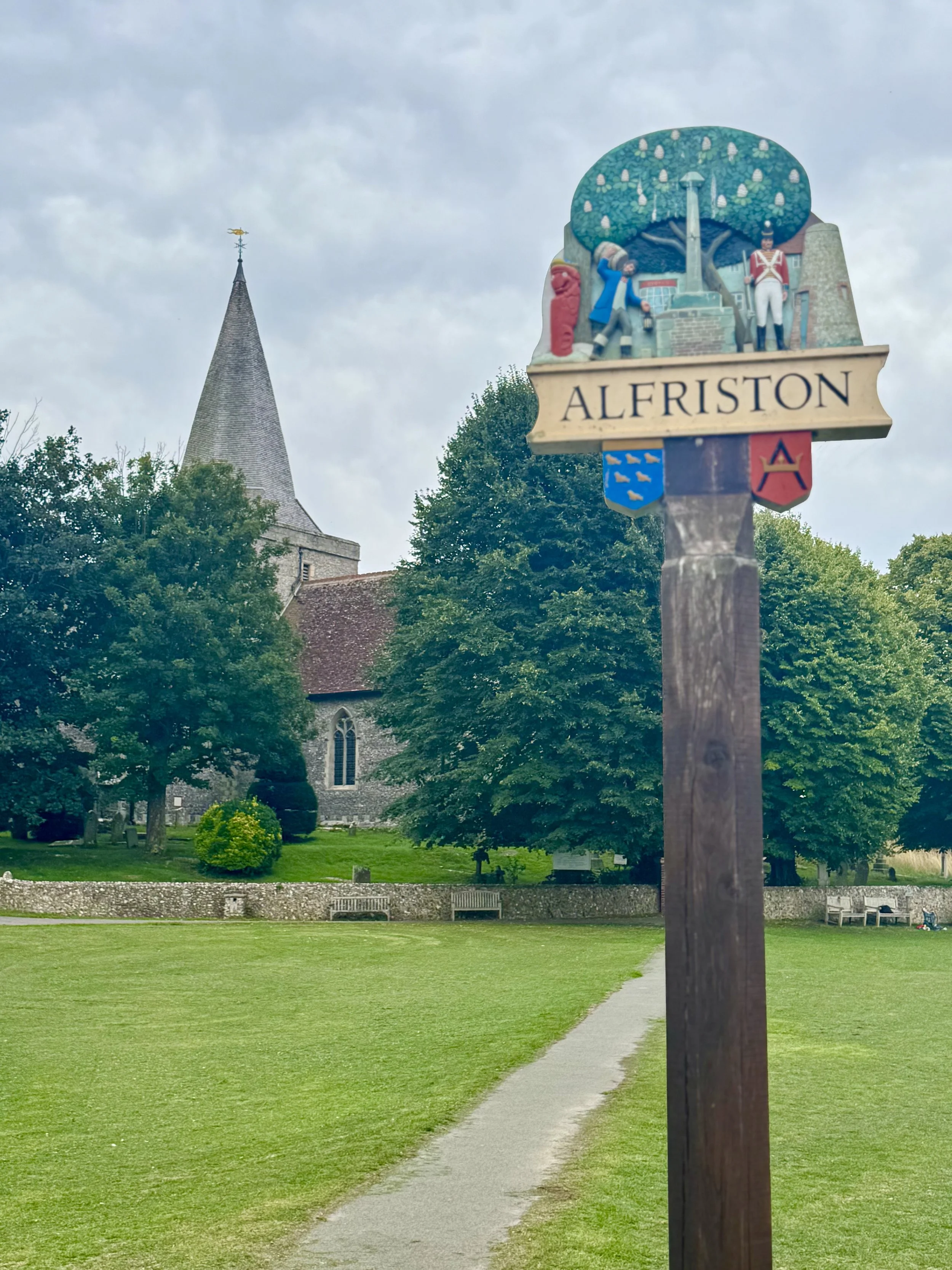
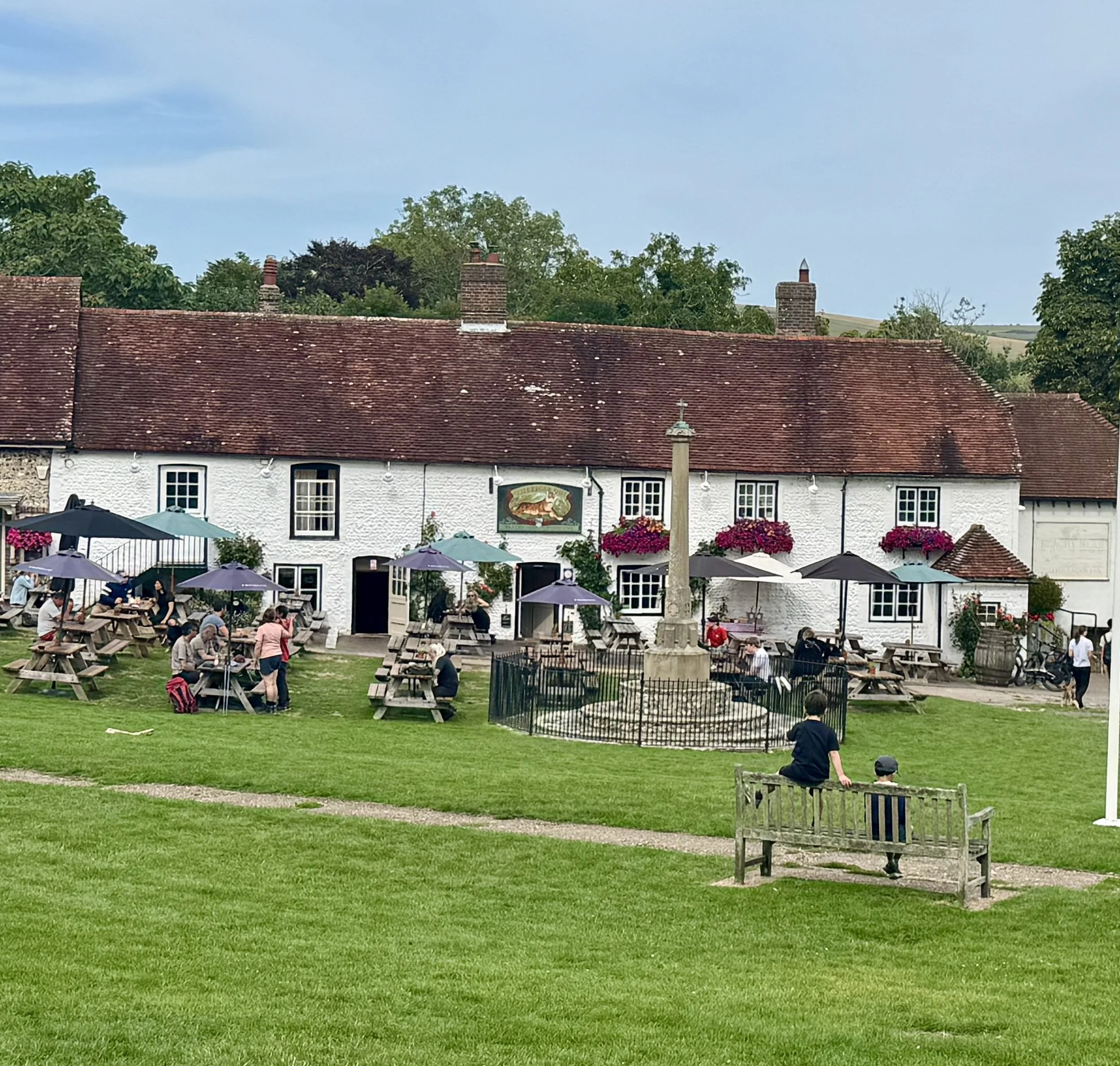
Some 30-40 minutes later, we approach Alfriston, first passing Alfriston Clergy House.
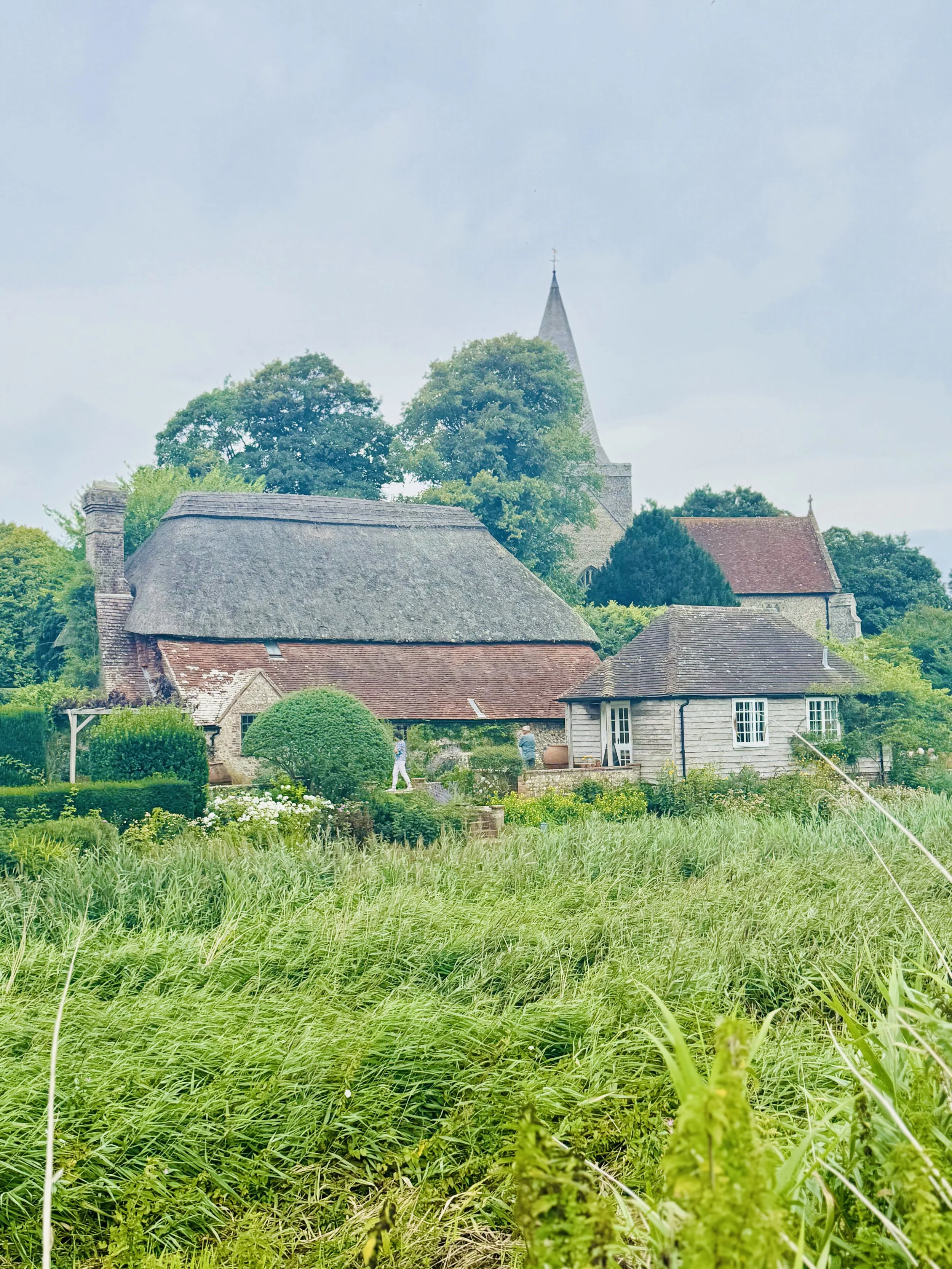
Just a little further, we turn left and cross a bridge, and it’s a short stroll through the Village Hall green, where Rich and i take a well-earned lunch break!
We get some food and a cold drink from The Gun Room Cafe adjacent to the Village Green, and sit outside on a nearby bench…lovely!
Alfriston: (18km)
Section 2 completed.
Note: If you’re finished your walk here, you can get back to Eastbourne using Cuckmere Buses - either the 25 bus or 26 bus.
Section 3: Alfriston to Hobb’s Eares 7km (25km/32km)
Feeling refreshed, it’s time to head back on the trail.
We cross the green to the left side of the Church and follow the track back to the bridge we crossed earlier.
Instead of turning right, we leave the River, and continue straight along a sheltered path for a short while. At the end of the path we come to Lullington Road, where we turn right.
Continue along Lullington Road, and then turn right onto The Street. No more than 100 yards, we spot an entrance on our left leading us back onto the trail (it’s easy to miss).
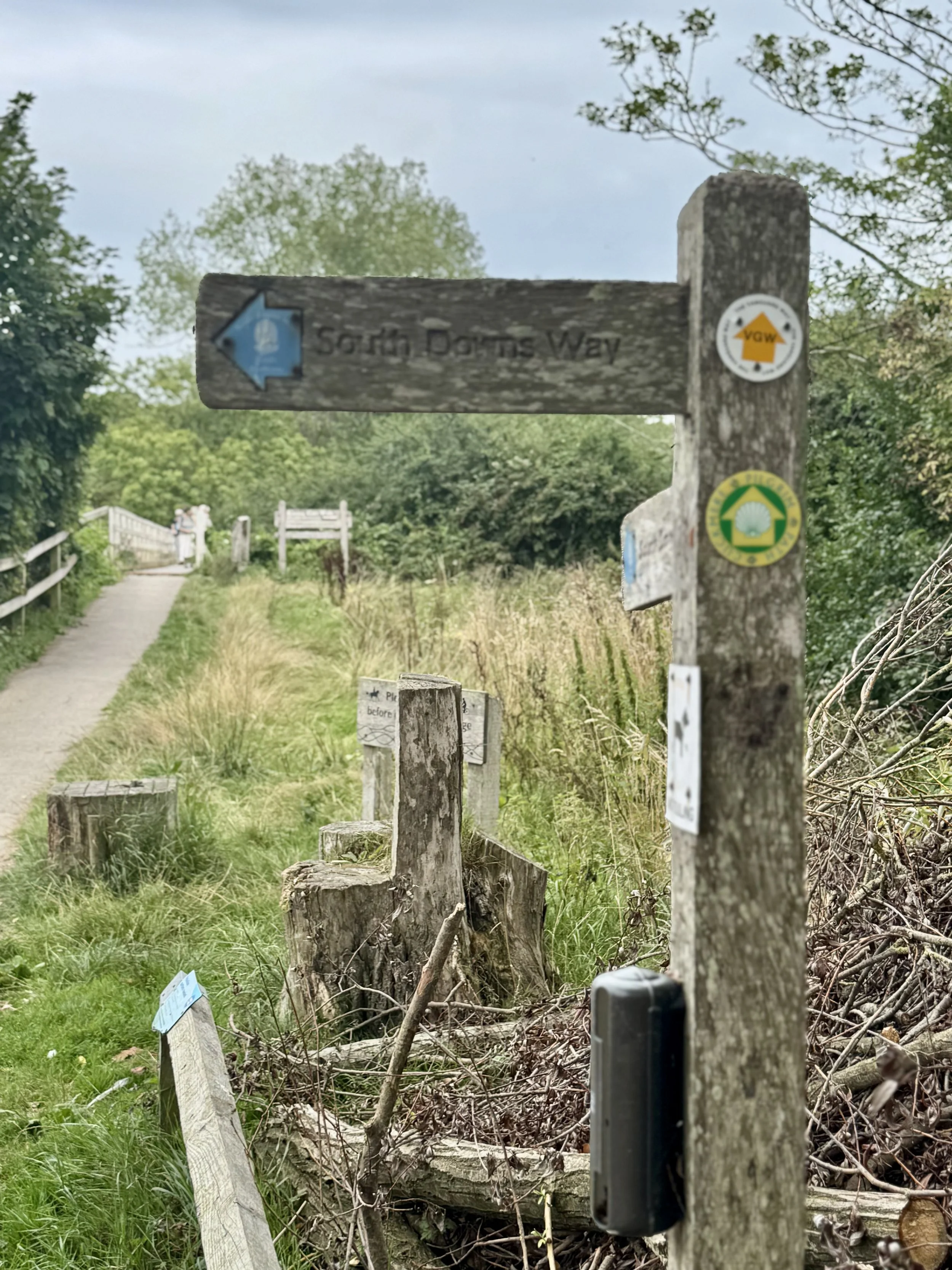
The track leads up to some open fields, with views of Alfriston behind, and the South Downs to our right. It’s a long steady stretch until we come to a small brow, with options to take a variety of turns. There’s a not very helpful marker post, seeming to highlight a public bridleway in every direction.
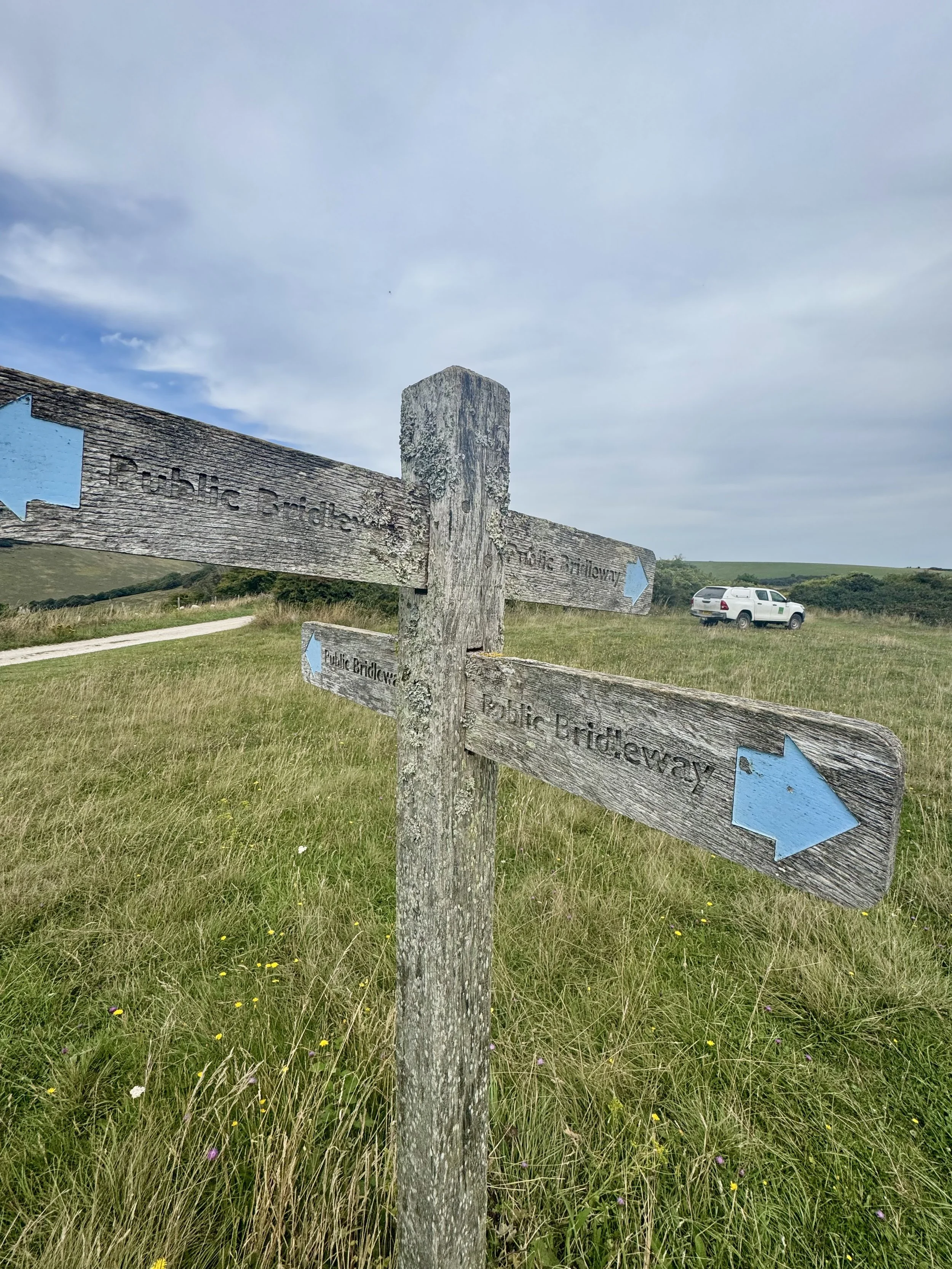
Fortunately i had marked out my route on OS Maps. So Rich and i took the path leading us right towards Lullington Heath.
It’s a gorgeous section, and being in the height of Summer, we’re smacked with colourful hues coming from the grass, trees, and meadow flowers in full bloom (21km).
It feels like a world away from the coastline we were walking this morning, even though it’s just a stone’s throw.
The path heads downhill then slowly climbs. It’s a long but steady walk, and by the time we reach a small road crossing, we know we’ve been pushing it.
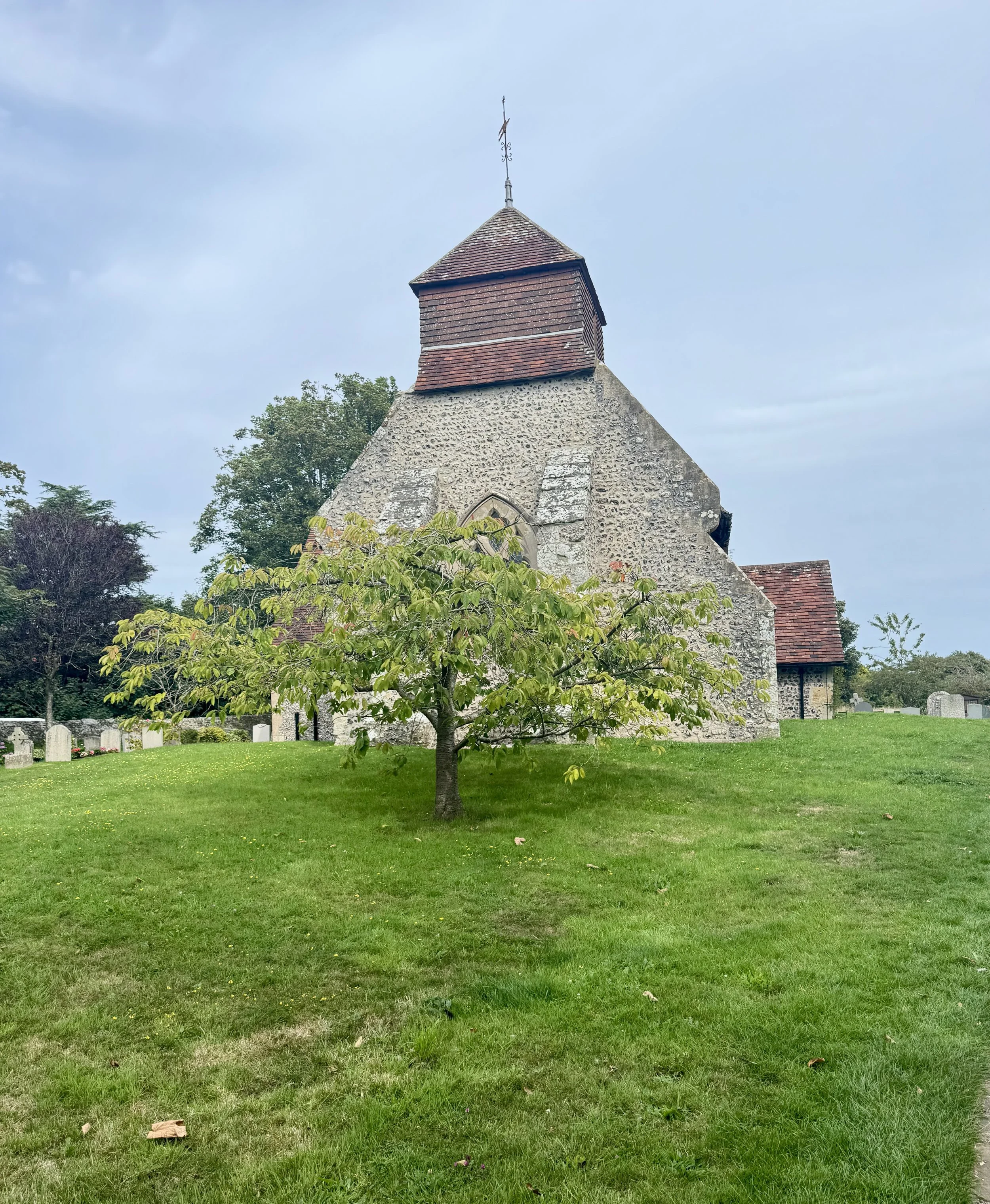
We turn right along the road, and head towards a crossing. Going straight across the road we enter a courtyard, at St Mary the Virgin churchyard. A gate marks the entrance where we walk through towards the rear of the Church gardens.
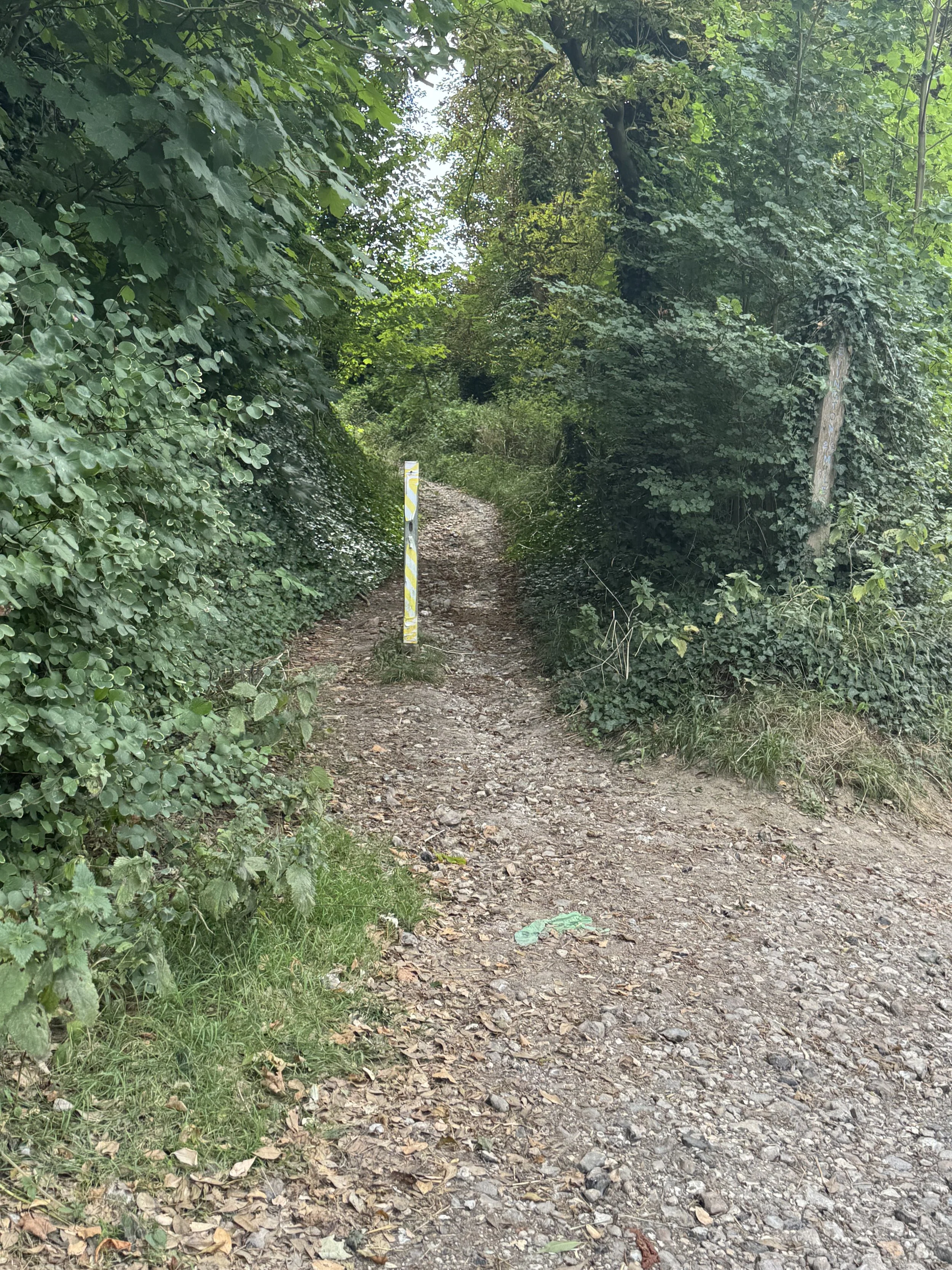
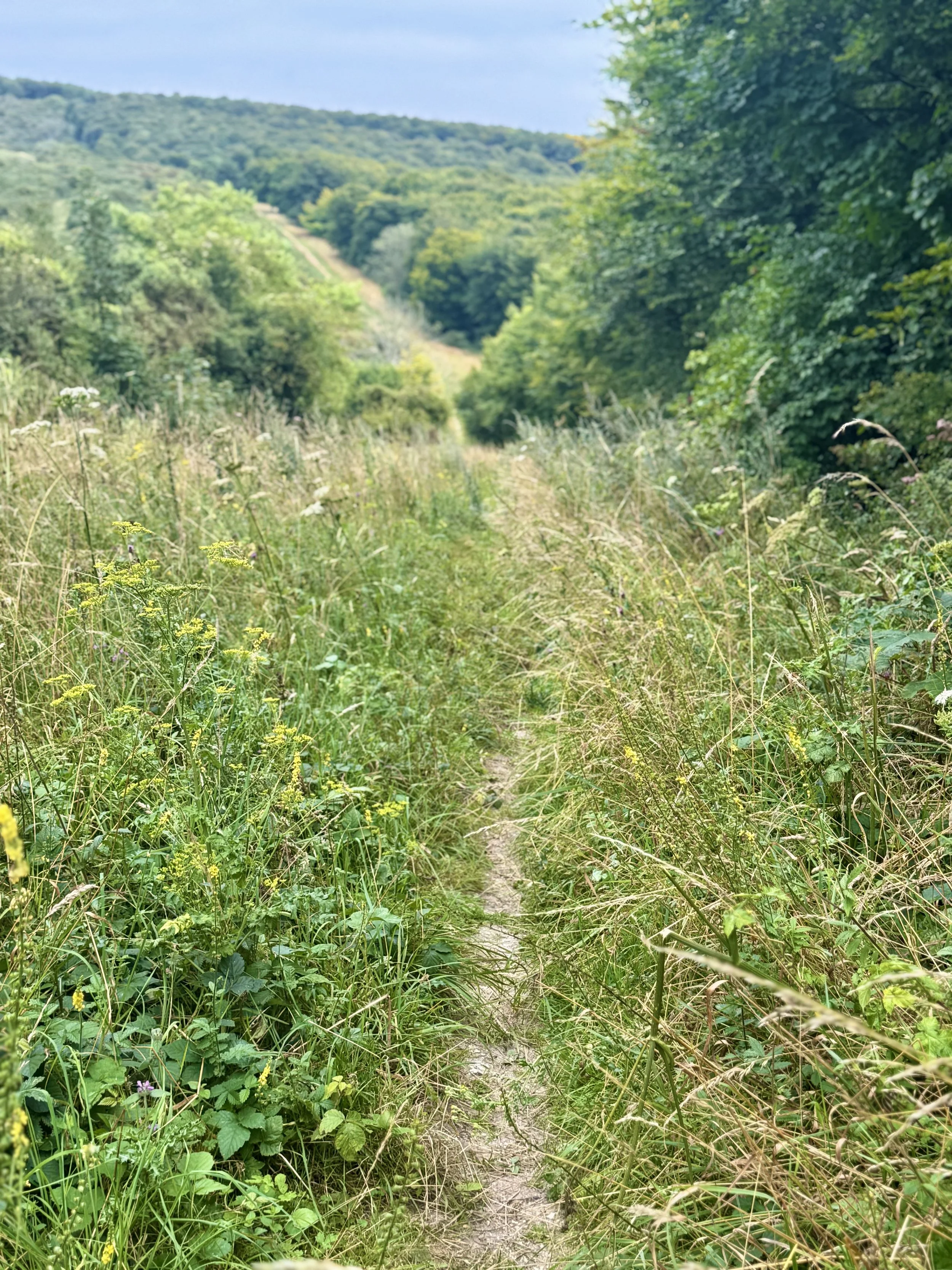
Behind the Church, lies the entrance to Hobb’s Eares - a sheltered woodland track, that skirts Friston Forest edge (25km).
Section 3 completed
Section 4: Hobb’s Eares to Beach Head Kiosk
7km (32km/32km)
From here we have a choice - bear right, and head back up onto the South Downs with the coastal views, or continue straight, and down through the valley towards East Dean.
We take the latter option. It’s been a long, hot day, and I’ve been taking on board so much water, that i could do with topping up my bottle for the final leg of our hike.
It’s only a short walk from here until we reach East Dean. We stop by the village green, that overlooks the Tiger Inn Pub, and i pop into the Deli on the Green to buy some water.
After a short break Rich and i head off once more, taking the short walk down the road that’s signposted towards Birling Gap.
Reaching Birling Manor, we pass through a gate, where we join the path that runs to the left of the manor.
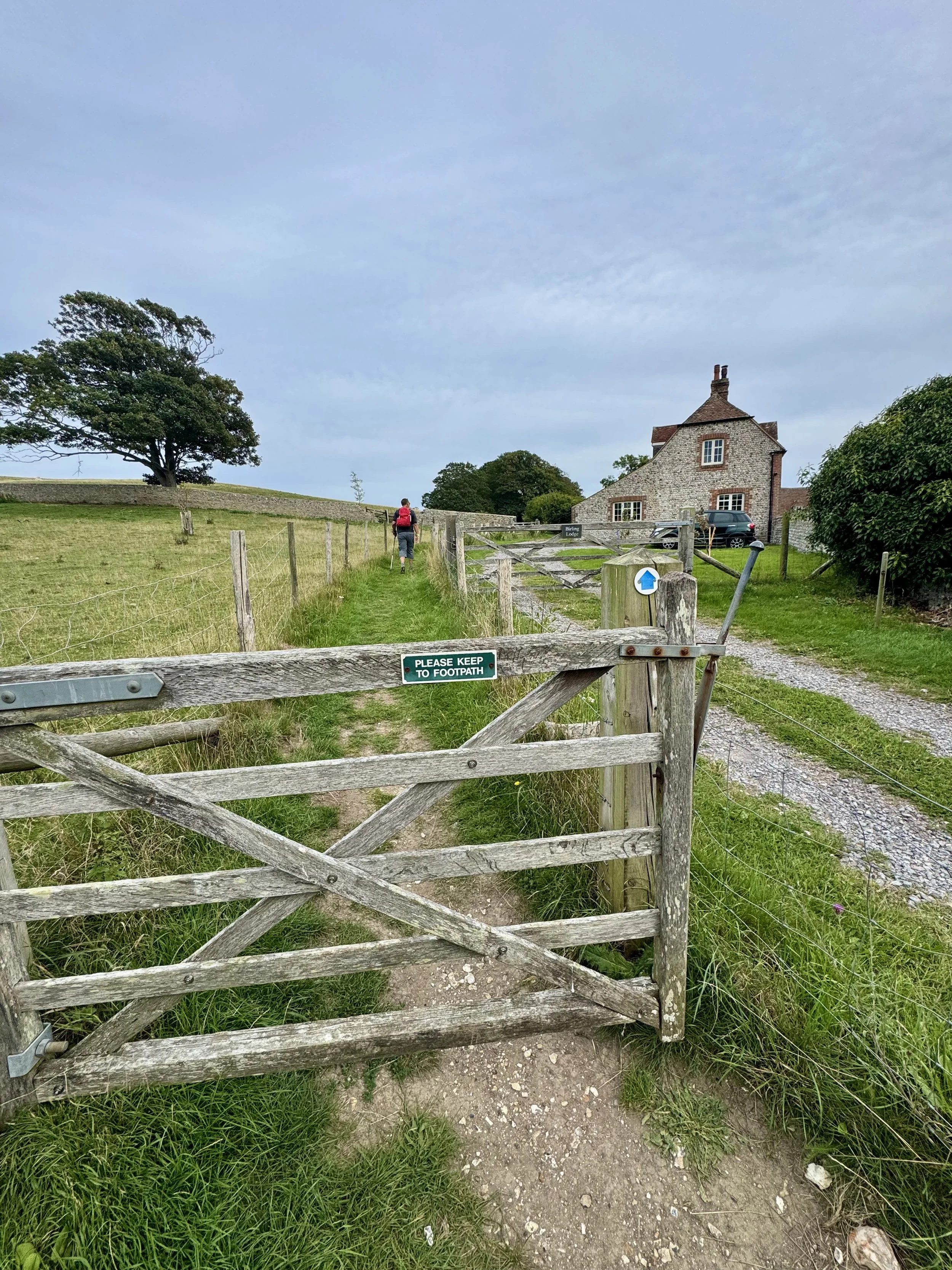
It’s a pretty stretch, with open fields on either side, that are separated by a low, stone wall.
Ten minutes later at the end of the field, we cross a track, and bear left into Cornish Farm, where we pass through a gate, that leads into a short, narrow path before it opens up again into a wide, open field (27km),
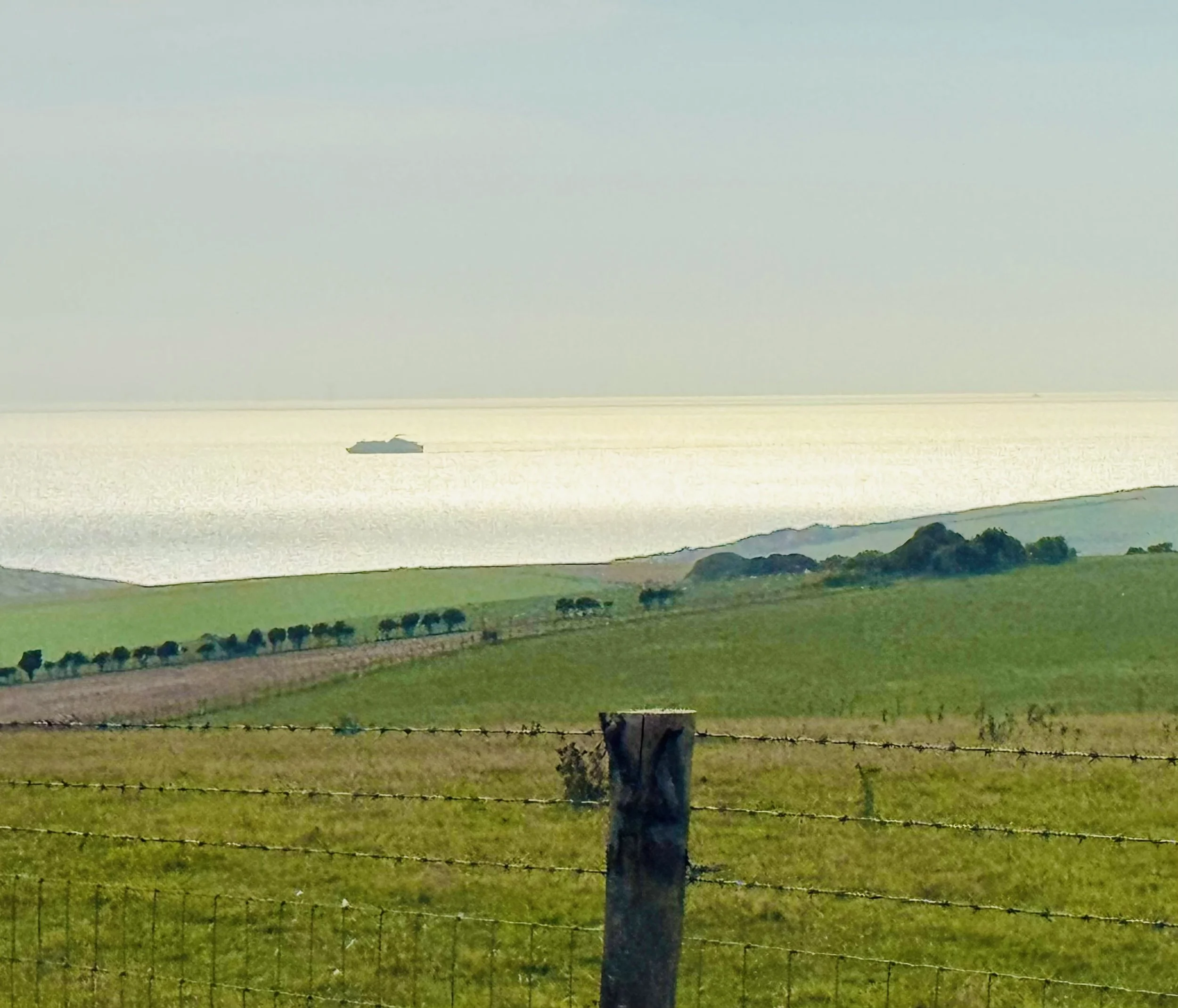
It’s a long, but straight trail now, and very pleasant. The Summer meadow flowers are back out in full force. Views of the sea lay to our right, and with the late afternoon sun beating down, it’s casting a warm, shimmering golden light over the water…gorgeous!
We continue for another 15 minutes until reaching Beachy Head Road (30m). We turn right along the side of the road, and around 50 yards further we cross over the road, and take the path along the brow of a hill, that drops as it heads back towards Eastbourne.
Just the last hill to descend now, and once again i stop to admire the beautiful array of meadow flowers, before we reach the foot of the hill at the Beachy Head Kiosk.

Section 4 and the Seven Sister to Alfriston Loop completed! (32km).
Summary
The Seven Sisters to Alfriston Loop is a true South Downs classic — a challenging, rewarding full-day hike that delivers a perfect mix of cliff-top drama, river valley tranquillity, historic villages, and downland wildlife.
Every few kilometres reveals a new highlight, from the isolated elegance of Belle Tout to the timeless calm of Alfriston’s village green. Whether you walk it for the views, the history, or the satisfying tiredness at the end, this route is one to remember.
Happy hiking!
Marc